West Pikeland Township near Chester Springs in Chester County, Pennsylvania — The American Northeast (Mid-Atlantic)
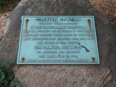
Chester Springs
Erected 1916 by Chester County Historical Society.
Topics. This historical marker is listed in these topic lists: Science & Medicine • War, US Revolutionary. A significant historical date for this entry is June 17, 1778.
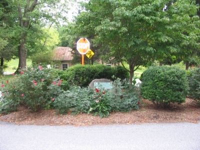
Location. 40° 6.005′ N, 75° 37.347′ W. Marker is near Chester Springs, Pennsylvania, in Chester County. It is in West Pikeland Township. Marker is at the intersection of Yellow Springs Road and Art School Road, on the right when traveling north on Yellow Springs Road. Touch for map. Marker is at or near this postal address: 1685 Art School Rd, Chester Springs PA 19425, United States of America. Touch for directions.
Other nearby markers. At least 8 other markers are within 5 miles of this marker, measured as the crow flies. Good News Productions (within shouting distance of this marker); a different marker also named Chester Springs (approx. 0.4 miles away); Lightfoot Mill (approx. 1.6 miles away); Graceanna Lewis (approx. 3.3 miles away); Valley Forge General Hospital (approx. 4.3 miles away); Weaver’s Cottage (approx. 4.3 miles away); Battle of the Clouds (approx. 4.7 miles away); Welkinweir (approx. 4.9 miles away). Touch for a list and map of all markers in Chester Springs.
Credits. This page was last revised on February 7, 2023. It was originally submitted on August 23, 2010, by Craig Swain of Leesburg, Virginia. This page has been viewed 829 times since then and 19 times this year. Last updated on May 22, 2019, by Carl Gordon Moore Jr. of North East, Maryland. Photos: 1, 2, 3, 4. submitted on August 23, 2010, by Craig Swain of Leesburg, Virginia. • Andrew Ruppenstein was the editor who published this page.


