Tahoe City in Placer County, California — The American West (Pacific Coastal)
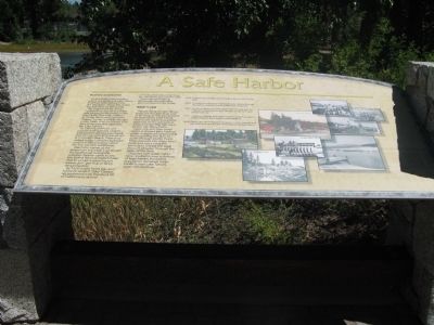
A Safe Harbor
Business and tourists
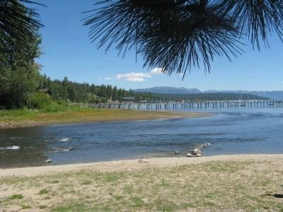
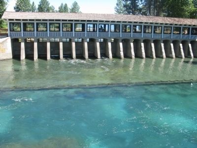
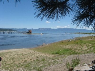
Outlet point is the location where the waters of Lake Tahoe find their only release from the lake basin along the Lower Truckee River at Tahoe City
The sheltered inlet of the Truckee River mouth provided safe harbor for fishermen in the late 1800s. Two early settlers at Outlet Point were Jeremiah “Johnny” Hurley and Billy Morgan. In the 1880s they partnered with two other men and operated the Lake Fishery.
By 1900 Outlet Point was popular with summer visitors who strolled along a boardwalk that connected it with the wharf at Commons Beach. There they visited Hurley’s simple clapboard structure affectionately called the Toy-Yat Club boathouse.
Abe Cohn, owner of the Emporium in Carson City, rented the boathouse during the summer. Tourists came to see the skilled Washoe basketmaker Dot So La Lee (Louisa Keyser) weave deh-‘gee-kup or fancy design baskets.
By 1920 Outlet Point was also home to Jacob P. “Jake” Obexer. He partnered with Standard Oil of California to deliver petroleum products by boat to customers around the lake.
Commercial boating dominates the activities around Outlet Point today.
Water is vital
People living at Lake Tahoe, along the Truckee River and as far away as Nevada depend on water from Lake Tahoe. How much water is available depends on the amount of snow and rain that falls each year in the Tahoe basin.
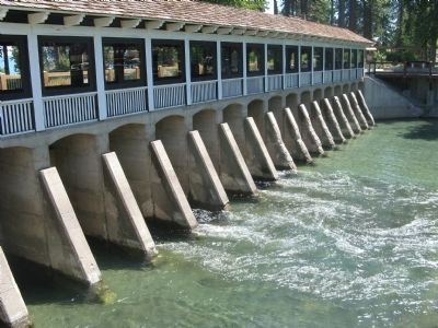
Laws regulate how much water everyone gets. Federal water masters are responsible for controlling the flow of water through Outlet Point. They measure the water level daily, and use a complex formula to release the legal amount of water through the gates of the dam.
Disputes over water rights have resulted in over a century of legal battles. Increasing population demands mean conflicts over Lake Tahoe’s water will continue.
1915 - Federal court set flow rates through a dam on the Truckee River
1935 - Truckee River Agreement allowed water release through the outlet to prevent flooding lakeshore properties.
1944 - Orr Ditch Decree specified water flow through dam for irrigation, power generation, storage and government and private use.
1971 - California-Nevada Interstate Compact agreed on ways to resolve disputes but Congress never ratified it.
1990 - Public Law 101-618 agrees on ways to settle disputes and will result in a new Truckee River Operating Agreement.
Erected by North Lake Tahoe Historical Society.
Topics. This historical marker is listed in this topic list: Natural Resources. A significant historical year for this entry is 1900.
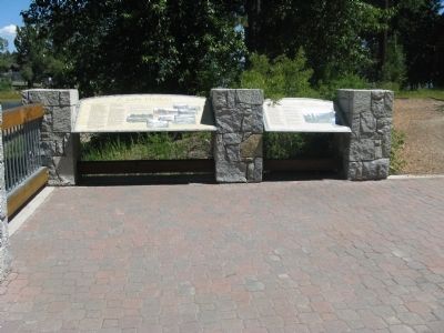
Location. 39° 9.99′ N, 120° 8.636′ W. Marker is in Tahoe City, California, in Placer County. Marker can be reached from West Lake Boulevard (State Highway 89) west of State Highway 26. Marker is located at the Lake Tahoe Outlet Gates near the Gatekeeper's Cabin Museum at William B. Layton Park. Touch for map. Marker is at or near this postal address: 130 West Lake Boulevard, Tahoe City CA 96145, United States of America. Touch for directions.
Other nearby markers. At least 8 other markers are within walking distance of this marker. The Sacred Lake (here, next to this marker); The Gatekeeper’s Cabin and Museum (a few steps from this marker); The Plentiful Lake (a few steps from this marker); A Tradition of Basketmaking (a few steps from this marker); Lake Tahoe (a few steps from this marker); William B. Layton Park (a few steps from this marker); Lake Tahoe Outlet Works and Gatekeepers Cabin (within shouting distance of this marker); Conflict Over Water (within shouting distance of this marker). Touch for a list and map of all markers in Tahoe City.
Related marker. Click here for another marker that is related to this marker. A Nevada State Historical Landmark Marker at the Gravesite of Dat-So-La-Lee
Also see . . .
1. Lake Tahoe Water Wars--Part 1 of 2. Tahoepedia website entry (Submitted on April 29, 2021, by Larry Gertner of New York, New York.)
2. Lake Tahoe Water Wars, Unending--Part 2 of 2. Tahoepedia website entry (Submitted on April 29, 2021, by Larry Gertner of New York, New York.)
Photographed By Syd Whittle, August 14, 2010
3. Lake Tahoe and the Headwaters of the Truckee River
"The Lake Tahoe Water War"
A short article on the issues of Lake Tahoe's water rights.
Snowy Range Reflections website entry
Click for more information.
A short article on the issues of Lake Tahoe's water rights.
Snowy Range Reflections website entry
Click for more information.
Additional keywords. Water Rights
Credits. This page was last revised on June 26, 2021. It was originally submitted on August 26, 2010, by Syd Whittle of Mesa, Arizona. This page has been viewed 922 times since then and 13 times this year. Photos: 1, 2, 3, 4, 5, 6. submitted on August 26, 2010, by Syd Whittle of Mesa, Arizona.
