High Point in Guilford County, North Carolina — The American South (South Atlantic)
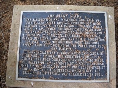
The Plank Road
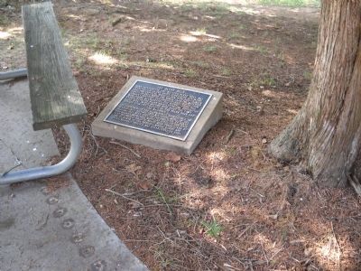
To commemorate the Plank Roadís significance in High Pointís history, this miniature model of the original has been constructed precisely to scale. The planks represent monetary gifts to the High Point Historical Society Plank Road funds given by or in honor of the persons whose names are inscribed. This replica was established in 1981.
Topics. This historical marker is listed in this topic list: Roads & Vehicles. A significant historical year for this entry is 1852.
Location. Marker has been reported permanently removed. It was located near 35° 58.795′ N, 79° 59.526′ W. Marker was in High Point, North Carolina, in Guilford County. Marker could be reached from McGuinn Drive, on the left when traveling north. Marker is located adjacent to the High Point Museum. Touch for map. Marker was in this post office area: High Point NC 27262, United States of America.
We have been informed that this sign or monument is no longer there and will not be replaced. This page is an archival view of what was.
Other nearby markers. At least 8 other markers are within walking distance of this location. The Little Red Schoolhouse (a few steps from this marker); The Blacksmith Shop (within shouting distance of this marker); The Hoggat House (within shouting distance of this marker); Quatercentenary Tree (within shouting distance of this marker); Oldest Building in High Point (within shouting distance of this marker); The Haley House (within shouting distance of this marker); Oldest Colonial Trail (within shouting distance of this marker); a different marker also named Haley House (within shouting distance of this marker). Touch for a list and map of all markers in High Point.
Credits. This page was last revised on January 8, 2023. It was originally submitted on August 26, 2010, by Bill Coughlin of Woodland Park, New Jersey. This page has been viewed 790 times since then and 26 times this year. Last updated on January 6, 2023, by Marian Inabinett of High Point, North Carolina. Photos: 1, 2, 3. submitted on August 26, 2010, by Bill Coughlin of Woodland Park, New Jersey. • J. Makali Bruton was the editor who published this page.


