South Thimble Island in Virginia Beach, Virginia — The American South (Mid-Atlantic)
The Chesapeake Bay : History Happened Here
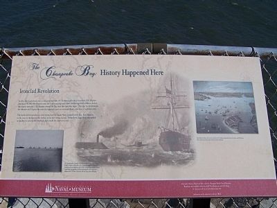
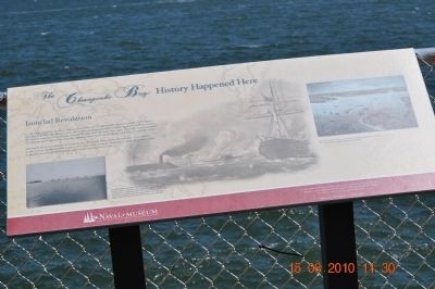
Ironclad Revolution
The battle did not produce a clear victory, but the Union Navy controlled the Bay. Fort Monroe, to the west at the harbor, never left Union control. From there, large fleets assembled in the Bay to enforce the blockade and invade the southern coast.
A Union squadron assembles in the Bay en route to attack Fort Fisher North Carolina in December 1864. Among the ships are a side-wheel cruiser (converted merchant ship) at left ; a steam frigate (center); several steam sloops and gunboats; a twin-turret monitor in the right center distance and USS New Ironside, the next large ship to the right.
Fort Monroe, lying to the west, is at the tip of the Virginia peninsula between the James and York rivers. this well-protected site ensured Union control of the Bay.
Erected by Hampton Roads Naval Museum Local History World Events.
Topics. This historical marker is listed in these topic lists: War, US Civil • Waterways & Vessels. A significant historical month for this entry is March 1968.
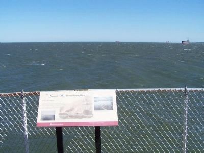
Location. 36° 57.984′ N, 76° 6.727′ W. Marker is in Virginia Beach, Virginia. It is on South Thimble Island. Marker is on Chesapeake Bay Bridge Tunnel (U.S. 13), on the right when traveling north. Marker is next to the fence overlooking the Bay. Touch for map. Marker is in this post office area: Virginia Beach VA 23455, United States of America. Touch for directions.
Other nearby markers. At least 8 other markers are within 5 miles of this marker, measured as the crow flies. The Chesapeake Bay: History Happened Here (a few steps from this marker); Tribute to Admiral de Grasse (within shouting distance of this marker); a different marker also named The Chesapeake Bay: History Happened Here (within shouting distance of this marker); Lucius J. Kellam, Jr. (within shouting distance of this marker); a different marker also named The Chesapeake Bay : History Happened Here (within shouting distance of this marker); a different marker also named The Chesapeake Bay : History Happened Here (within shouting distance of this marker); Adam Thorowgood (approx. 4.2 miles away); Meeting of Three Commanders (approx. 4.3 miles away). Touch for a list and map of all markers in Virginia Beach.
Also see . . . Wikipedia:CSS Virginia. CSS Virginia was a steam-powered ironclad warship of the Confederate States Navy during the American Civil War, built as floating battery using the remains of the scuttled USS Merrimack in 1862. (Submitted on August 25, 2010, by Sandra Hughes Tidwell of Killen, Alabama, USA.)
Credits. This page was last revised on February 1, 2023. It was originally submitted on August 25, 2010, by Sandra Hughes Tidwell of Killen, Alabama, USA. This page has been viewed 945 times since then and 22 times this year. Last updated on August 27, 2010, by Sandra Hughes Tidwell of Killen, Alabama, USA. Photos: 1. submitted on October 24, 2010, by Mike Stroud of Bluffton, South Carolina. 2, 3. submitted on August 25, 2010, by Sandra Hughes Tidwell of Killen, Alabama, USA. 4. submitted on October 24, 2010, by Mike Stroud of Bluffton, South Carolina. • Kevin W. was the editor who published this page.


