Burlington in Alamance County, North Carolina — The American South (South Atlantic)
Battle of Alamance

National Park Service, Thomas Stone National Historic Site, May 28, 2019
1. Battle of Alamance Marker, Left Panel
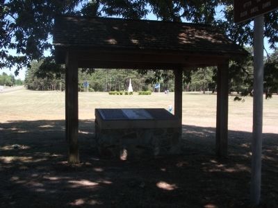
Viewing east towards marker.
North Carolina Highway Historical Marker Program website entry
Click for more information.
North Carolina Highway Historical Marker Program website entry
Click for more information.
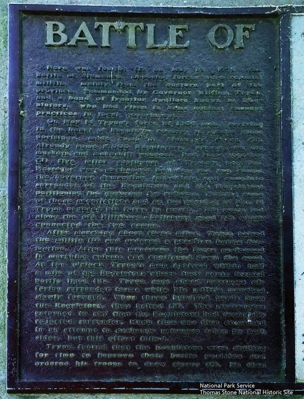
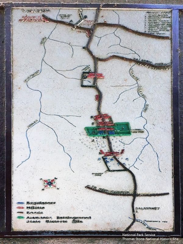
On May 14 Tryon’s force of 1,100 men, arriving in the heart of Regulator country to subdue these uprisings, made camp on Alamance Creek (B). Already some 2,000 Regulators, armed with old muskets and makeshift weapons, had come together (J) five miles southwest of Tryon’s position. Messages were exchanged between the camps, the governor demanding immediate and complete surrender of the Regulators and the Regulators petitioning the governor for reforms. Nothing came of the negotiations and on the morning of May 16 Tryon ordered his force to march. His route led along the old Hillsboro-Salisbury road (C) which connected the two camps.
After marching about three miles, Tryon halted the militia (D) and ordered a practice battle formation. After this maneuver the force re-formed in marching column and continued down the road. At ten o’clock Tryon’s men arrived within half a mile of the Regulators where they again formed battle lines (E). Tryon sent ahead messages offering surrender terms while his militia marched slowly forward. When three hundred yards from the Regulators, they halted (F). The messengers returned to say that the Regulators had scornfully rejected surrender. Much time was then consumed in an attempt to exchange prisoners taken by both sides, but this effort failed.
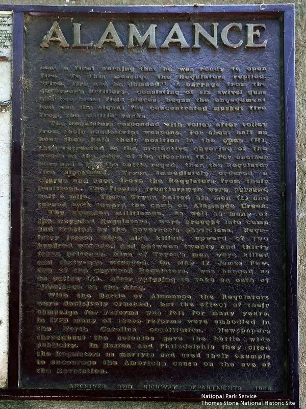
Tryon feared that the Regulators were stalling for time to improve their battle position and ordered his troops to draw closer (G). He then sent a final warning that he was ready to open fire. To this message the Regulators replied, “Fire, fire and be damned.” A barrage from the governor’s artillery, consisting of six swivel guns and two brass field pieces, began the engagement and was the signal for concentrated musket fire from the militia ranks.
The Regulators responded with volley after volley from their nondescript weapons. For half an hour they held their position in the open (H), then retreated to the protective covering of the woods at the edge of the clearing (K). For another hour and a half the battle raged, then the Regulator fire slackened. Tryon immediately ordered a charge and soon drove the Regulators from their positions. The fleeing frontiersmen were pursued half a mile. There Tryon halted his men (L) and turned back toward the camp on Alamance Creek.
The wounded militiamen, as well as many of the wounded Regulators, were brought into camp and treated by the Governor’s
physicians. Regulator losses were nine killed, upward of two wounded and between twenty and thirty taken prisoner. Nine of Tryon’s men were killed and sixty-one wounded. On May 17 James Few, one of the captured Regulators, was hanged as an outlaw (A), after refusing to take an oath of allegiance to the king.
With the Battle of Alamance the Regulators were decisively crushed, but the effect of their campaign for reforms was felt for many years. In 1776 many of these reforms were embodied in the North Carolina constitution. Newspapers throughout the colonies gave the battle wide publicity. In Boston and Philadelphia they cited the Regulators as martyrs and used their example to encourage the American cause on the eve of the Revolution.
Erected 1956 by Archives and Highway Departments. (Marker Number GG-1.)
Topics and series. This historical marker is listed in this topic list: War, US Revolutionary. In addition, it is included in the North Carolina Division of Archives and History series list. A significant historical month for this entry is May 1900.
Location. 36° 0.487′ N, 79° 31.299′ W. Marker is in Burlington, North Carolina, in Alamance County. Marker is at the intersection of NC Highway 62 and Clapp Mill Road, on the left when traveling south on NC Highway 62. Located at Alamance
Battleground, a State of North Carolina Historic Site. Directions from I-85/40. Exit 143. Travel South on NC Highway 62 for 5.8 miles. Entrance to Battleground is on the right. Marker is beyond the entrance, on your left. Touch for map. Marker is at or near this postal address: 5803 NC Highway 62, Burlington NC 27215, United States of America. Touch for directions.
Other nearby markers. At least 8 other markers are within walking distance of this marker. The Regulators' Field (here, next to this marker); Governor Tryon and the Militia (a few steps from this marker); First Battle of the Revolution (about 300 feet away, measured in a direct line); Battle of Alamance Monument (about 300 feet away); a different marker also named Battle of Alamance (about 300 feet away); Pugh's Rock (about 400 feet away); The Battle of the Alamance (about 400 feet away); Colonial Column (about 400 feet away). Touch for a list and map of all markers in Burlington.
Also see . . . Alamance Battleground, North Carolina Historic Sites. (Submitted on September 18, 2019.)
Credits. This page was last revised on May 29, 2022. It was originally submitted on August 29, 2010, by Patrick G. Jordan of Graham, North Carolina. This page has been viewed 1,700 times since then and 47 times this year. Photos: 1, 2, 3. submitted on September 18, 2019. 4. submitted on August 29, 2010, by Patrick G. Jordan of Graham, North Carolina. • Bill Pfingsten was the editor who published this page.


