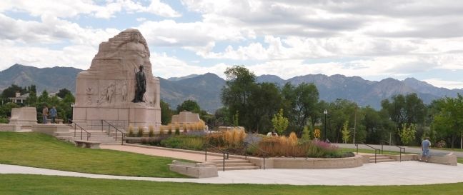
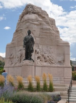
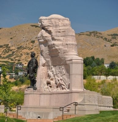
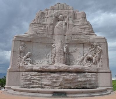
Capitol Hill in Salt Lake City in Salt Lake County, Utah — The American Mountains (Southwest)
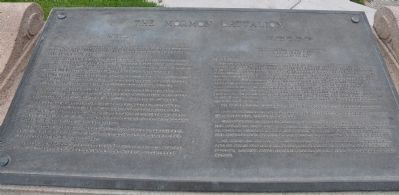
The Mormon Battalion
History
In May and June 1846, the services of the Mormon people--en route to the west--were officially tendered to the United States government, then at war with Mexico.
President James K. Polk authorized Colonel Stephen W. Kearney, Commander of the Army of the West, to enlist five hundred Mormon volunteers and march to California. Captain James Allen, who was detailed to make the enlistment, arrived at the Mormon camps June 26.
After three weeks recruiting with the aid of Brigham Young and other officials of the Mormon Church, the Battalion was mustered into the United States Service at Council Bluffs, Iowa, July 16.
The march was via Ft. Leavenworth, Kansas; thence to Santa Fe, New Mexico, where the Battalion arrived in two divisions in October. Here Lieutenant-Colonel P. St. George Cooke was given command.
The Battalion left Santa Fe October 19 and marched southward down the Rio del Norte to 32º41' North latitude; thence south and westward to near the headwaters of the San Pedro; north and westward to Tucson; and so to the Pacific. The march of over two thousand miles ended at San Diego, January 29, 1947.
The Battalion served in garrison duty in San Diego, San Luis Rey and Los Angeles, and in outpost duty at Cajon Pass until the term of enlistment ended July 16, 1947.
Eighty-one members of the Battalion re-enlisted for six months additional service and were known as "The Mormon Volunteers"
Achievements
"Headquarters Mormon Battalion Mission of San Diego January 30, 1947"
"Order No. 1"
"History may be searched in vain for an equal march of infantry•••through a wilderness, where nothing but savages and wild beasts are found, or deserts where, for want of water, there is no living creature.•••We have dug deep wells, which the future traveler will enjoy.•••Ventured into trackless tablelands where water was not found for several marches.•••Worked our way over mountains and hewed a pass through a chasm of living rock•••to bring these first wagons to the Pacific•••The garrison•••of Tucson, gave us no pause, we drove them out with their artillery, but our intercourse with the citizens was unmarked by a single act of injustice, thus, marching half naked and half fed, and living upon wild animals, we have discovered and made a road of great value to our country.•••
By order Lieut-Colonel P. St. George Cooke, P. C. Merrill, Adjutant"
Seven members of the Battalion participated in the discovery of gold in California, January 24, 1948
Detachments of the Battalion that had been invalided to Pueblo on the Arkansas—numbering one hundred fifty men—joined Brigham Young's original pioneer company, and participated in founding the Commonwealth of Utah
By their justice to the conquered, by their courage and endurance, and by their patriotic devotion, the members of the Mormon Battalion brought lasting honor to their people, to the state of Utah and to their nation
Erected 1927 by Utah State Legislature - Monument Commission.
Topics and series. This historical marker is listed in these topic lists: Churches & Religion • Patriots & Patriotism • War, Mexican-American. In addition, it is included in the Mormon Battalion series list. A significant historical date for this entry is January 29, 1849.
Location. 40° 46.583′ N, 111° 53.232′ W. Marker is in Salt Lake City, Utah, in Salt Lake County. It is in Capitol Hill. Marker is at the intersection of 300 North and East Capitol Blvd., on the right when traveling east on 300 North. The monument is located at the southeast corner of the Utah State Capitol grounds where 300 North makes a bend to the north and merges into East Capitol Blvd. Touch for map. Marker is at or near this postal address: 350 N State Street, Salt Lake City UT 84103, United States of America. Touch for directions.
Other nearby markers. At least 8 other markers are within walking distance of this marker. Old City Hall (about 300 feet away, measured in a direct line); The 18th Ward Chapel (about 300 feet away); Council Hall (about 300 feet away); Statue of Massassoit (about 400 feet away); Ottinger Hall (about 600 feet away); Thomas L. Kane (about 700 feet away); Daniel Cowan Jackling (about 800 feet away); Ensign Peak (approx. 0.2 miles away). Touch for a list and map of all markers in Salt Lake City.
Photographed By Bryan R. Bauer, August 27, 2010
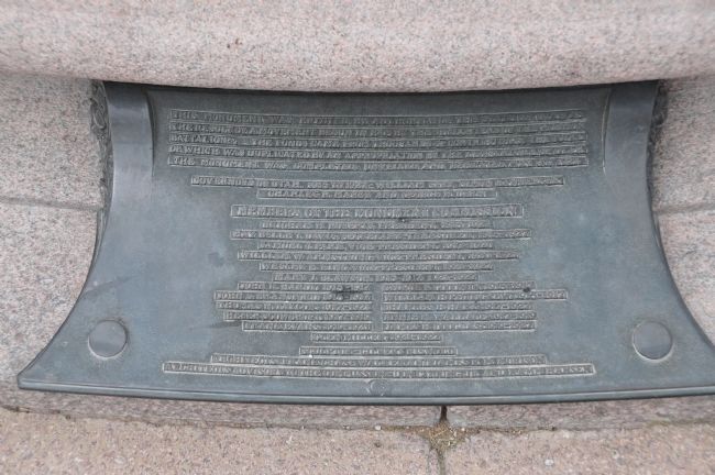
6. Monument Dedication Plaque
This monument was erected by authorization of the state of Utah as the result of a movement begun in 1905 by the "Daughters of the Mormon Battalion". The funds came from thousands of contributors, the total of which was duplicated by an appropriation by the legislature of Utah. The monument was completed, unveiled and dedicated May 30, 1927.
Credits. This page was last revised on February 16, 2023. It was originally submitted on September 2, 2010, by Bryan R. Bauer of Kearns, Ut 84118. This page has been viewed 1,296 times since then and 25 times this year. Photos: 1, 2, 3, 4, 5, 6. submitted on September 2, 2010, by Bryan R. Bauer of Kearns, Ut 84118. • Syd Whittle was the editor who published this page.
