Annandale in Fairfax County, Virginia — The American South (Mid-Atlantic)
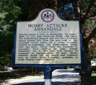
Mosby Attacks Annandale
Erected 2009 by The Fairfax County History Commission.
Topics and series. This historical marker is listed in this topic list: War, US Civil. In addition, it is included in the Virginia, Fairfax County History Commission series list. A significant historical year for this entry is 1864.
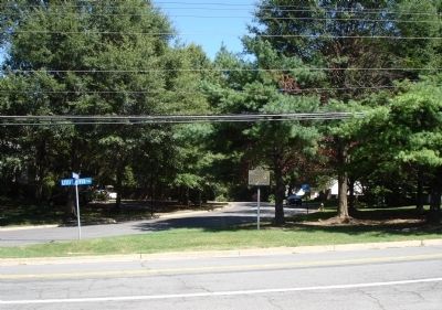
Location. 38° 50.001′ N, 77° 12.733′ W. Marker is in Annandale, Virginia, in Fairfax County. Marker is at the intersection of Little River Turnpike (State Highway 236 Frontage Road) and Championship Drive, on the right when traveling east on Little River Turnpike. Marker is located at the corner of Championship Drive and Little River Turnpike (service drive), one block west of Hummer Road. Touch for map. Marker is in this post office area: Annandale VA 22003, United States of America. Touch for directions.
Other nearby markers. At least 8 other markers are within 2 miles of this marker, measured as the crow flies. Little River Turnpike (approx. 0.8 miles away); The Cannon (approx. one mile away); Gooding's Tavern (approx. 1.3 miles away); The Guinea Road Cemetery Reinterment (approx. 1.4 miles away); Action At Annandale (approx. 1˝ miles away); The Pines (approx. 1.7 miles away); Ravensworth (approx. 1.7 miles away); a different marker also named Ravensworth (approx. 1.7 miles away). Touch for a list and map of all markers in Annandale.
Also see . . . August 24, 1864. -- Skirmish At Annandale. Official Reports. No.l. -- Lieat. Col. Henry H. Wells, Twenty-sixth Michigan Infantry, Provost-Marshal-General of Defenses South of the Potomac. No. 2 -- Capt. Joseph Schneider, Sixteenth New York Cavalry. (Submitted on September 4, 2010.)
Credits. This page was last revised on June 16, 2016. It was originally submitted on September 4, 2010. This page has been viewed 3,018 times since then and 67 times this year. Photos: 1, 2. submitted on September 4, 2010. • Craig Swain was the editor who published this page.

