Oakton in Fairfax County, Virginia — The American South (Mid-Atlantic)
Hunter Mill Road
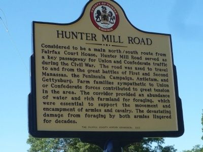
Considered to be a main north/south route from Fairfax Court House. Hunter Mill Road served as a key passageway for Union and Confederate traffic during the Civil War. The road was used to travel to and from the great battles of First and Second Manassass, the Peninsula Campaign, Antietam, and Gettysburg. Farm families sympathetic to Union and Confederate forces contributed to great tension in the area. The corridor provided an abundance of water and rick farmland for foraging, which were essential to support the movement and encampment of armies and cavalry. The devastating damage from foraging by both armies lingered for decades.
Erected 2009 by Fairfax County History Commission.
Topics and series. This historical marker is listed in these topic lists: Environment • Roads & Vehicles • War, US Civil. In addition, it is included in the Virginia, Fairfax County History Commission series list.
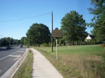
Location. 38° 53.195′ N, 77° 18.096′ W. Marker is in Oakton, Virginia, in Fairfax County. Marker is on Hunter Mill Road (Virginia Route 674) north of Chain Bridge Road (Virginia Route 123), on the right when traveling north. Touch for map. Marker is in this post office area: Oakton VA 22124, United States of America. Touch for directions.
Other nearby markers. At least 8 other markers are within 2 miles of this marker, measured as the crow flies. Second and Third Oakton Schools (1874-1912) (within shouting distance of this marker); The Beginning of Oakton Schools (1848-1873) (within shouting distance of this marker); Ira Noel Gabrielson (approx. 0.2 miles away); Chain Bridge Road and Hunter Mill Road, Oakton, Virginia (approx. 0.4 miles away); Historic Cemeteries (approx. half a mile away); First Baptist Church of Vienna (approx. 1.6 miles away); Cavalry Engagement near Hunter's Mill (approx. 1.8 miles away); Peyton Anderson (approx. 1.9 miles away). Touch for a list and map of all markers in Oakton.
More about this marker. Although authorized in 2009, the marker was not placed until July 2010.
Also see . . . Hunter Mill Defense League. The league's fundamental goal has been to preserve and protect the scenic and historic character of the distinctive Hunter Mill Road Corridor. (Submitted on September 7, 2010, by Craig Swain of Leesburg, Virginia.)
Additional keywords. Army of the Potomac; Army of Northern Virginia.
Credits. This page was last revised on June 16, 2016. It was originally submitted on September 6, 2010, by Richard E. Miller of Oxon Hill, Maryland. This page has been viewed 1,853 times since then and 30 times this year. Photos: 1, 2. submitted on September 6, 2010, by Richard E. Miller of Oxon Hill, Maryland. • Craig Swain was the editor who published this page.

