Near Garfield in Benton County, Arkansas — The American South (West South Central)
"Dat De Shpot, Sergent!"
Pea Ridge National Military Park
— National Park Service, U.S. Department of the Interior —
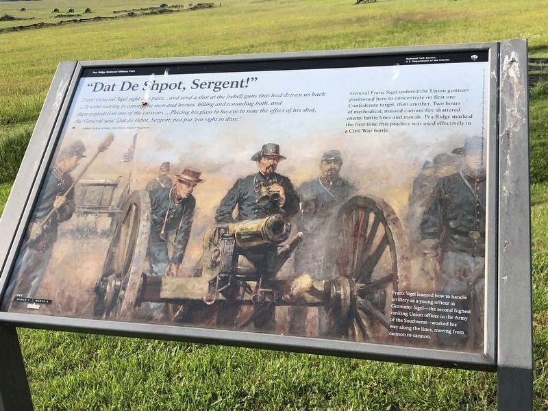
I saw General Sigel sight one piece...and send a shot at the [rebel] guns that had driven us back...It went tearing in among the men and horses, killing and wounding both, and then exploded in one of the caissons...Placing his glass to his eye to note the effect of his shot, the General said 'Dat de shpot, Sergent; just put 'em right in dare.'
Samuel McKay, private, 37th Illinois Infantry Regiment
General Franz Sigel ordered the Union gunners positioned here to concentrate on first one Confederate target, then another. Two hours of methodical, massed cannon fire shattered enemy battle lines and morale. Pea Ridge marked the first time this practice was used effectively in a Civil War battle.
Franz Sigel learned how to handle artillery as a young officer in Germany. Sigel - the second highest ranking Union officer in the Army of the Southwest - worked his way along the lines, moving from cannon to cannon.
Erected by National Park Service, U.S. Department of the Interior.
Topics. This historical marker is listed in this topic list: War, US Civil.
Location. 36° 26.841′ N, 94° 1.534′ W. Marker is near Garfield, Arkansas, in Benton County. Marker is on Military Park Road (County Road 65), on the right when traveling south. Located at stop ten, the Federal Line, on the driving tour of Pea Ridge National Military Park. Touch for map. Marker is in this post office area: Garfield AR 72732, United States of America. Touch for directions.
Other nearby markers. At least 8 other markers are within walking distance of this marker. That Beautiful Charge (here, next to this marker); A Perfect Storm of Shot and Shell (approx. ¼ mile away); Confederate Sunset (approx. ¼ mile away); They Passed This Way (approx. 0.4 miles away); It was the Grandest Thing I Ever Saw... (approx. half a mile away); Night Moves (approx. half a mile away); Slaughter in the Rocks (approx. half a mile away); Fiery Finale on Ruddick's Field (approx. half a mile away). Touch for a list and map of all markers in Garfield.
Also see . . .
1. Pea Ridge National Military Park. National Park Service entry (Submitted on September 13, 2010, by Craig Swain of Leesburg, Virginia.)
2. The Battle of Pea Ridge. American Battlefield trust website entry (Submitted on September 13, 2010, by Craig Swain of Leesburg, Virginia.)

Photographed By Craig Swain, August 30, 2010
4. Federal Gun Line
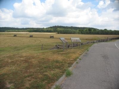
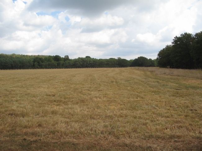
Looking northwest across Cox's Field. The artillery pieces here represent the massed Federal batteries formed in the morning of March 8. Most of the Federal batteries were armed with 6-pdr guns and 12-pdr howitzers. In the distance is a rise of ground known as Welfley's Knoll, named for Captain Martin Welfley commander of a battery of Missouri artillery.
Credits. This page was last revised on June 19, 2023. It was originally submitted on September 13, 2010, by Craig Swain of Leesburg, Virginia. This page has been viewed 1,308 times since then and 23 times this year. Photos: 1. submitted on June 4, 2023, by Duane and Tracy Marsteller of Murfreesboro, Tennessee. 2, 3, 4, 5. submitted on September 13, 2010, by Craig Swain of Leesburg, Virginia.


