Dallas in Paulding County, Georgia — The American South (South Atlantic)
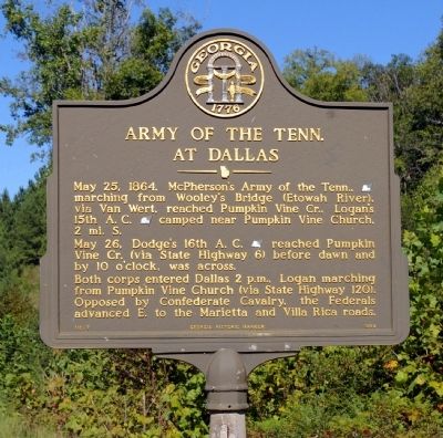
Army of the Tenn. At Dallas
May 26, Dodge’s 16th A.C. [US] reached Pumpkin Vine Cr. (via State Highway 6) before dawn & by 10 o’clock, was across.
Both corps entered Dallas 2 p.m., Logan marching from Pumpkin Vine Church (via State Highway 120). Opposed by Confederate Cavalry, the Federals advanced E. to the Marietta and Villa Rica roads.
Erected 1989 by Georgia Department of Natural Resources. (Marker Number 110-7.)
Topics and series. This historical marker is listed in this topic list: War, US Civil. In addition, it is included in the Georgia Historical Society series list. A significant historical date for this entry is May 25, 1750.
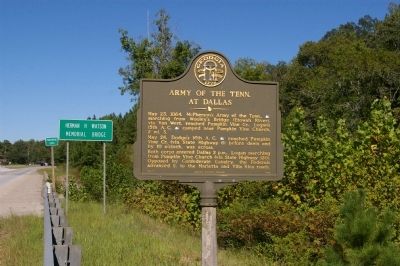
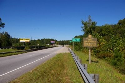
Location. 33° 54.946′ N, 84° 52.706′ W. Marker is in Dallas, Georgia, in Paulding County. Marker is on Rockmart Highway (U.S. 278) 0.2 miles east of Homer Cochran Road. The marker is located at the west end of the bridge where the eastbound lane of US Highway 278 crosses Pumpkinvine Creek. Touch for map. Marker is in this post office area: Dallas GA 30132, United States of America. Touch for directions.
Other nearby markers. At least 8 other markers are within 3 miles of this marker, measured as the crow flies. Davis' Div. at Dallas (approx. 2.2 miles away); Paulding County (approx. 2.2 miles away); A. Lafayette Bartlett (approx. 2.2 miles away); Dallas (approx. 2.3 miles away); Dallas - New Hope Line (approx. 2.6 miles away); The Orphan Brigade at Dallas (approx. 2.8 miles away); Rt. of Federal Line May 26 -June 1, 1864 (approx. 2.9 miles away); Armstrong's Advance (approx. 2.9 miles away). Touch for a list and map of all markers in Dallas.
More about this marker. This marker replaced an earlier marker of the same title and text erected by the Georgia Historical Commission near this location.
Credits. This page was last revised on June 16, 2016. It was originally submitted on September 15, 2010, by David Seibert of Sandy Springs, Georgia. This page has been viewed 1,209 times since then and 28 times this year. Photos: 1, 2, 3. submitted on September 15, 2010, by David Seibert of Sandy Springs, Georgia. • Craig Swain was the editor who published this page.


