Near Middlesboro in Bell County, Kentucky — The American South (East South Central)
Two-Way Traffic
Cumberland Gap National Historical Park
— National Park Service, U.S. Department of the Interior —
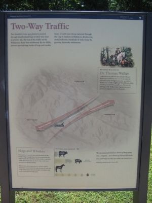
Two hundred years ago, pioneers poured through Cumberland Gap on their way west to a better life. But not all the traffic on the Wilderness Road was westbound. By the 1820s, drovers pushed huge herds of hogs and smaller herds of cattle and sheep eastward through the Gap to markets in Baltimore, Richmond, and Charleston, hundreds of miles from the growing Kentucky settlements.
Before Daniel Boone there was
Dr. Thomas Walker
Cumberland Gap still bears the name Dr. Thomas Walker gave it when he came over the mountain in 1750 with a party of Virginia real estate speculators. Walker was a wealthy neighbor of Peter Jefferson, father of future president Thomas Jefferson. The journals and maps of Dr. Walker's trans-Appalachian travels promoted emigration west into Kentucky.
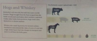
Hogs and Whiskey
Kentucky's soil was rich, but cash was scarce on the frontier. Hogs brought from the East escaped into the fertile woods and canebrakes; their numbers exploded. Unlike other bulky farm products, hogs could carry themselves to distant markets.
Whiskey also made big money for western settlers. Distillation concentrated the value of acres of corn into a high-dollar liquor that was cheaper to transport and easier to sell than the bulky grain.
One Kentucky county's typical trade -- 1838
We encountered immense droves of hogs going into... Virginia...two droves of 700 or 800 each; and yesterday we met two others as numerous...
Wilderness Road traveler's letter, 1823
Erected by National Park Service, U.S. Department of the Interior.
Topics. This historical marker is listed in these topic lists: Exploration • Industry & Commerce • Settlements & Settlers. A significant historical year for this entry is 1750.
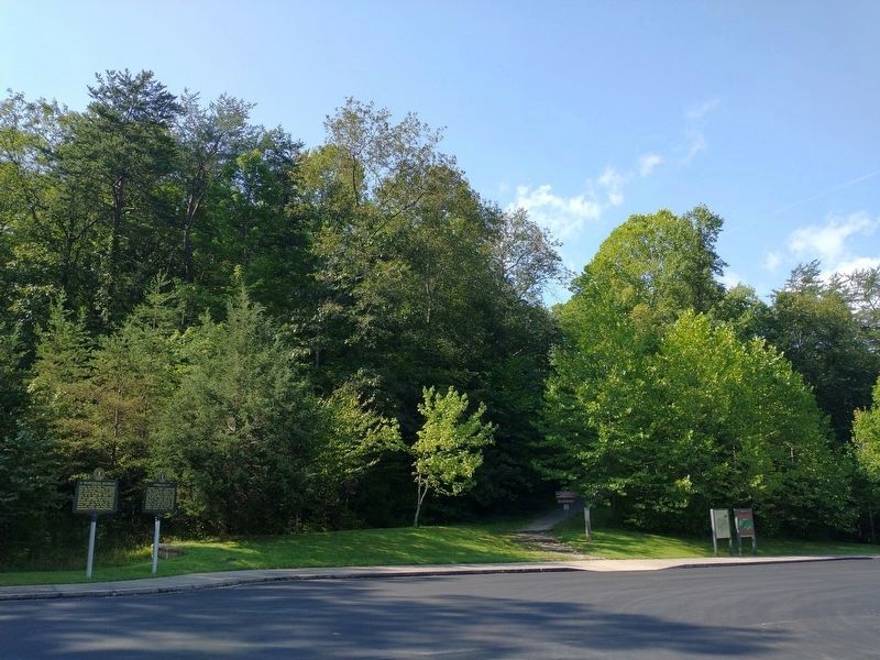
Location. 36° 36.541′ N, 83° 40.674′ W. Marker is near Middlesboro, Kentucky, in Bell County. Marker is on Pinnacle Road, on the right when traveling east. Located at the Thomas Walker parking area in Cumberland Gap National Historical Park. Touch for map. Marker is in this post office area: Middlesboro KY 40965, United States of America. Touch for directions.
Other nearby markers. At least 8 other markers are within walking distance of this marker. Cumberland Gap / Grant Visits Cumberland Gap (a few steps from this marker); A Masterful Retreat (within shouting distance of this marker); An Object Lesson Road (within shouting distance of this marker); Warriors' Path (about 300 feet away, measured in a direct line); Forts and Batteries, North and South (approx. 0.2 miles away); Two Armies, One Railroad (approx. 0.2 miles away); a different marker also named An Object Lesson Road (approx. ¼ mile away); Wilderness Road (approx. 0.3 miles away). Touch for a list and map of all markers in Middlesboro.
Also see . . . Cumberland Gap National Historical Park. (Submitted on September 19, 2010, by Craig Swain of Leesburg, Virginia.)
Credits. This page was last revised on September 9, 2021. It was originally submitted on September 19, 2010, by Craig Swain of Leesburg, Virginia. This page has been viewed 1,031 times since then and 30 times this year. Last updated on February 16, 2021, by Carl Gordon Moore Jr. of North East, Maryland. Photos: 1, 2, 3, 4. submitted on September 19, 2010, by Craig Swain of Leesburg, Virginia. 5. submitted on September 5, 2021, by Tom Bosse of Jefferson City, Tennessee. • Devry Becker Jones was the editor who published this page.
