Southwest Houston in Harris County, Texas — The American South (West South Central)
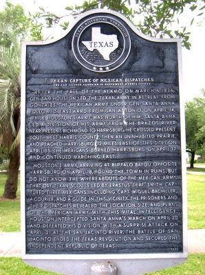
Texan Capture of Mexican Dispatches
The San Jacinto Campaign in Southwest Harris County
After the fall of the Alamo on March 6, 1836, Gen. Sam Houston led the Texan Army in retreat from Gonzales. The Mexican army under Gen. Santa Anna followed eastward from San Antonio. On April 14, while Houston's army was north of him, Santa Anna led a division of his army from the Brazos River near present Richmond to Harrisburg. He crossed present southwest Harris County, then an uninhabited prairie, and reached Harrisburg (12 miles east of this site) on April 15. The Mexicans burned Harrisburg on April 17 and continued marching east.
Houston's army, arriving at Buffalo Bayou opposite Harrisburg on April 18, found the town in ruins, but did not know the whereabouts of the Mexican army. That day, Texan scouts led by Erastus "Deaf" Smith captured three Mexicans, including Capt. Miguel Bachiller, a courier, and a guide in this vicinity. The prisoners and their dispatches revealed the location, size, and plans of the Mexican army. With this vital intelligence, Houston intercepted Santa Anna's march on April 20 and defeated his division with a surprise attack on April 21 at the San Jacinto River. The Battle of San Jacinto ended the Texas Revolution and secured the independent Republic of Texas.
Erected 1989 by Texas Historical Commission. (Marker Number 10791.)
Topics. This historical marker is listed in this topic list: War, Texas Independence. A significant historical month for this entry is March 1747.
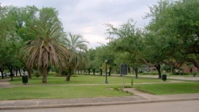
Location. 29° 42.345′ N, 95° 27.867′ W. Marker is in Houston, Texas, in Harris County. It is in Southwest Houston. Marker is on North 2nd Street north of Bellaire Boulevard, on the left when traveling north. Touch for map. Marker is in this post office area: Bellaire TX 77401, United States of America. Touch for directions.
Other nearby markers. At least 8 other markers are within 3 miles of this marker, measured as the crow flies. Bellaire Presbyterian Church (approx. 0.2 miles away); Bellaire Streetcar Line (approx. 0.2 miles away); Bellaire (approx. 0.3 miles away); Teas Nursery Company (approx. 0.8 miles away); City of West University Place (approx. 1.7 miles away); Hamilton Shirts (approx. 2 miles away); Chinese Texans and Civil Rights (approx. 2.1 miles away); Temple Lodge No. 4 A.F. & A.M. (approx. 2.6 miles away). Touch for a list and map of all markers in Houston.
Credits. This page was last revised on February 1, 2023. It was originally submitted on September 19, 2010, by Gregory Walker of La Grange, Texas. This page has been viewed 1,709 times since then and 25 times this year. Last updated on July 11, 2022, by Joe Lotz of Denton, Texas. Photos: 1, 2. submitted on September 19, 2010, by Gregory Walker of La Grange, Texas. • J. Makali Bruton was the editor who published this page.

