Seabrook in Harris County, Texas — The American South (West South Central)
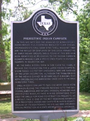
Prehistoric Indian Campsite
In this vicinity are the remains of a prehistoric Indian refuse pile, comprised mainly of clam shells. Archeologists call such sites "shell middens." They are the result of centuries of shellfish harvesting by early Indian groups. Shells found at this site have been identified as belonging to the Rangia cuneata (common rangia) clam, a species once found in abundant numbers in Galveston Bay.
As the shell midden grew in size over the years, it became the foundation for a large Indian campsite. Stone tools and pottery uncovered here are evidence of the later occupation. Although the tribal origins of the Indians cannot be determined, it is known that both Orcoquisac and Karankawa once lived in the area in historic times.
Shell middens similar to this one were once more common along the streams feeding into the bay. Storms, subsidence, and natural erosion, however, have destroyed many, as have mining operations that used the shells for road construction projects. As a result, this is one of the best remaining examples of a prehistoric midden and campsite in Harris County. Because of its significance, the site has been afforded special protection as a State Archeological Landmark.
Erected 1988 by Texas Historical Commission. (Marker Number 10746.)
Topics. This historical marker is listed in these topic lists: Man-Made Features • Native Americans.
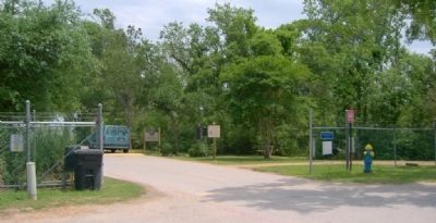
Location. 29° 35.534′ N, 94° 59.654′ W. Marker is in Seabrook, Texas, in Harris County. Marker can be reached from Pine Gully Road, 0.2 miles east of Todville Road, on the right when traveling east. Touch for map. Marker is in this post office area: Seabrook TX 77586, United States of America. Touch for directions.
Other nearby markers. At least 8 other markers are within 5 miles of this marker, measured as the crow flies. Captain William Plunkett Harris (approx. 0.6 miles away); Houston Yacht Club (approx. 1.8 miles away); Isaiah P. Walker House (approx. 2 miles away); Ritson Morris and Elmwood Plantation (approx. 2 miles away); Kemah (approx. 4.2 miles away); Sylvan Beach Pavilion (approx. 4.2 miles away); The La Porte-Sylvan Beach Depot (approx. 4.4 miles away); La Porte's Original Library (approx. 4.4 miles away). Touch for a list and map of all markers in Seabrook.
Credits. This page was last revised on February 1, 2023. It was originally submitted on September 19, 2010, by Gregory Walker of La Grange, Texas. This page has been viewed 2,235 times since then and 93 times this year. Photos: 1, 2. submitted on September 19, 2010, by Gregory Walker of La Grange, Texas. • Bill Pfingsten was the editor who published this page.

