Surry in Surry County, Virginia — The American South (Mid-Atlantic)
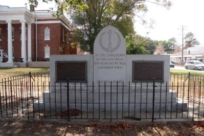
Surry County War Memorial
“At the going down
of the sun and in
the morning we will
remember them.”
Erected A.D. 1947
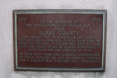
(Left)
1917 - 1918
To the members of
the Armed Forces of World War I
from
Surry County
They fought that democracy might survive.
They with their comrades in arms bore high the
torch of freedom. In victory they kept its flame
alive and passed it on to a later generation in
their fight for the liberties of man.
To them with pride and grateful remembrance
of their patriotism and valorous service
their county has erected this memorial.
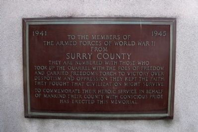
(Right)
1941 - 1945
To the members of
the Armed Forces of World War II
from
Surry County
They are numbered with those who
took up the quarrel with the foes of freedom
and carried freedom’s torch to victory over
despotism and oppression. They kept the faith.
They fought that civilization might survive.
To commemorate their heroic service in behalf
of mankind, their county with conscious pride
has erected this memorial.
Erected 1947.
Topics. This memorial is listed in these topic lists: War, World I • War, World II.
Location. 37° 8.274′ N, 76° 50.092′ W. Marker is in Surry, Virginia, in Surry County. Memorial can be reached from Colonial Trail East (Virginia Route 10) near Rolfe Highway (Virginia Route 31). Touch for map. Marker is at or near this postal address: 28 Colonial Trail East, Surry VA 23883, United States of America. Touch for directions.
Other nearby markers. At least 8 other markers are within 2 miles of this marker, measured as the crow flies. Chanco (a few steps from this marker); Surry County Confederate Monument (a few steps from this marker); Capt. Jacob Faulcon, C.S.A. (within shouting distance of this marker); Smith’s Fort Plantation (about 600 feet away, measured in a direct line); Surry County WWII Veterans Memorial (approx. 0.3 miles away); Organization of the Christian Church (approx. 1.1 miles away); Pleasant Point (approx. 1.7 miles away); Chippokes Plantation (approx. 1.7 miles away). Touch for a list and map of all markers in Surry.
Credits. This page was last revised on June 16, 2016. It was originally submitted on September 22, 2010, by Bernard Fisher of Richmond, Virginia. This page has been viewed 841 times since then and 13 times this year. Photos: 1, 2, 3. submitted on September 22, 2010, by Bernard Fisher of Richmond, Virginia.


