Penelope Neighbors in Atlanta in Fulton County, Georgia — The American South (South Atlantic)
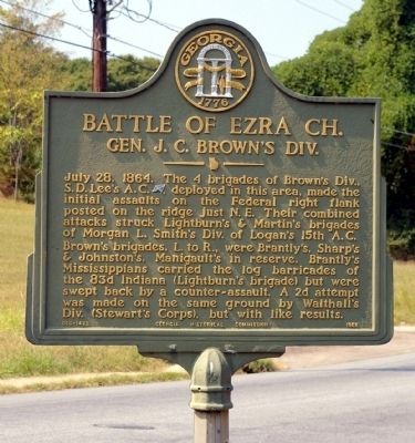
Battle of Ezra Ch.
Gen. J. C. Brown’s Div.
Brown’s brigades, L. to R., were Brantly’s, Sharp’s & Johnston’s, Manigault’s in reserve. Brantly’s Mississippians carried the log barricades of the 83d Indiana (Lightburn’s brigade) but were swept back by a counter-assault. A 2d attempt was made on the same ground by Walthall’s Div. (Stewart’s Corps), but with like results.
Erected 1958 by Georgia Historical Commission. (Marker Number 060-149B.)
Topics and series. This historical marker is listed in this topic list: War, US Civil. In addition, it is included in the Georgia Historical Society series list. A significant historical date for this entry is July 28, 1864.
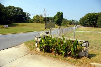
Location. 33° 45.3′ N, 84° 26.859′ W. Marker is in Atlanta, Georgia, in Fulton County. It is in Penelope Neighbors. Marker is on Waterbury Drive, 0.1 miles west of Anderson Avenue, on the right when traveling west. Touch for map. Marker is at or near this postal address: 1821 Waterbury Drive, Atlanta GA 30314, United States of America. Touch for directions.
Other nearby markers. At least 8 other markers are within walking distance of this marker. A different marker also named Battle of Ezra Ch. (approx. ¼ mile away); a different marker also named Battle of Ezra Ch. (approx. 0.3 miles away); Battle of Ezra Church (approx. 0.4 miles away); Clayton's Div., Lee's A.C. (approx. half a mile away); Battlefield of Ezra Church (approx. half a mile away); a different marker also named Battle of Ezra Church (approx. 0.6 miles away); The Confederate Attack (approx. 0.6 miles away); The Battle of Ezra Church / The Preliminary Operations (approx. 0.6 miles away). Touch for a list and map of all markers in Atlanta.
Credits. This page was last revised on February 8, 2023. It was originally submitted on September 23, 2010, by David Seibert of Sandy Springs, Georgia. This page has been viewed 1,211 times since then and 15 times this year. Photos: 1, 2. submitted on September 23, 2010, by David Seibert of Sandy Springs, Georgia. • Craig Swain was the editor who published this page.

