Fort Scott in Bourbon County, Kansas — The American Midwest (Upper Plains)
"The Crack Post of the Frontier"
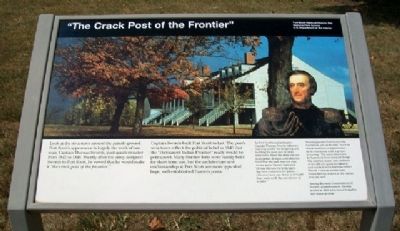
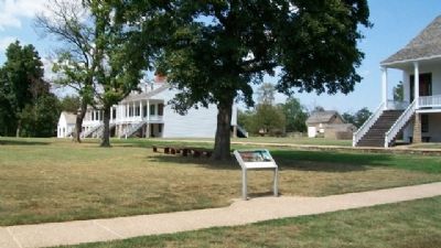
Look at the structures around the parade ground. Fort Scott’s appearance is largely the work of one man, Captain Thomas Swords, post quartermaster from 1842 to 1846. Shortly after the army assigned Swords to Fort Scott, he vowed that he would make it “the crack post of the frontier.”
Captain Swords built Fort Scott to last. The post’s structures reflect the political belief in 1843 that the “Permanent Indian Frontier” really would be permanent. Many frontier forts were hastily built for short-term use, but the architecture and craftsmanship at Fort Scott are more typical of large, well-established Eastern posts.
[Photo caption reads] As Fort Scott’s quartermaster, Captain Thomas Swords (above) was responsible for designing and building the post and all of its structures. Since the army did not standardize designs until after the Civil War, the task was not easy. At one point Swords lamented, “[I] am thrown entirely upon my own resources for plans….[No one] here can draw a straight line, even with the assistance of a ruler.”
Swords planned Fort Scott to be functional, yet, as he said, “with as much neatness of appearance as is consistent with a proper economy.” For some structures he borrowed from classical design. The porches, stairs, and rooflines of the officers quarters (above) and enlisted men’s barracks reflect French Colonial architecture. Greek Revival is seen in the canopy over the well.
Among the most conscientious of frontier quartermasters, Swords retired in 1869 a brevetted brigadier and major general.
Erected 1998 by National Park Service, U.S. Department of the Interior.
Topics and series. This historical marker is listed in these topic lists: Architecture • Forts and Castles. In addition, it is included in the Fort Scott, Kansas, and the National Historic Landmarks series lists. A significant historical year for this entry is 1842.
Location. 37° 50.612′ N, 94° 42.244′ W. Marker is in Fort Scott, Kansas, in Bourbon County. Marker can be reached from Old Fort Boulevard. Marker is on the grounds of Fort Scott National Historic Site. Touch for map. Marker is in this post office area: Fort Scott KS 66701, United States of America. Touch for directions.
Other nearby markers. At least 8 other markers are within walking distance of this marker. Infantry Life (a few steps from this marker); Quartermaster Complex (within shouting distance of this marker); Where Was the Bathroom? (within shouting distance of this marker); The Heart of Fort Scott (within shouting distance of this marker); Free to Learn (about 300 feet away,
measured in a direct line); Tallgrass Prairie Trail (about 300 feet away); Back Yards (about 300 feet away); Rank, Privilege, and Officers Row (about 300 feet away). Touch for a list and map of all markers in Fort Scott.
Also see . . .
1. Building Fort Scott. (Submitted on September 26, 2010, by William Fischer, Jr. of Scranton, Pennsylvania.)
2. General Thomas Swords. (Submitted on September 26, 2010, by William Fischer, Jr. of Scranton, Pennsylvania.)
3. Thomas Swords' Gravesite. (Submitted on September 26, 2010, by William Fischer, Jr. of Scranton, Pennsylvania.)
Credits. This page was last revised on September 9, 2020. It was originally submitted on September 26, 2010, by William Fischer, Jr. of Scranton, Pennsylvania. This page has been viewed 958 times since then and 11 times this year. Photos: 1, 2. submitted on September 26, 2010, by William Fischer, Jr. of Scranton, Pennsylvania.

