Greenbelt in Prince George's County, Maryland — The American Northeast (Mid-Atlantic)
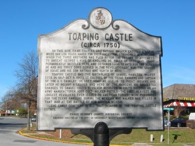
Toaping Castle
(Circa 1750)
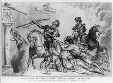
Toaping Castle was the birthplace of Samuel Hamilton Walker (Feb 24, 1817–October 9, 1847), Lt. Colonel of the Texas Rangers and captain of the U.S. Cavalry. He left home at age 19 to fight Indians, and later he became a leader and hero of the Rangers. His suggested changes to Samuel Colt’s revolver resulted in Colt's success as an arms manufacturer. 1000 Colt-Walker pistols—the first, heaviest and longest revolvers ever issued to American forces—were purchased for the Texas Rangers during the Mexican War. Walker was killed in that war at the battle of Hua Mantla, Mexico.
The family cemetery is all that remains of the Toaping Castle estate.
Erected 1976 by Prince George's County Historical Society, City of Greenbelt Bicentennial Committee.
Topics. This historical marker is listed in these topic lists: Cemeteries & Burial Sites • Colonial Era • Forts and Castles • Industry & Commerce • Settlements & Settlers • War, Mexican-American • War, US Revolutionary • Wars, US Indian. A significant historical date for this entry is October 9, 1732.
Location. 38° 59.802′ N, 76° 53.697′ W. Marker is in Greenbelt, Maryland, in Prince George's County. Marker is at the intersection of Walker Drive and Capitol Drive, on the right when traveling north on Walker Drive. Touch for map. Marker is in this post office area: Greenbelt MD 20770, United States of America. Touch for directions.
Other nearby markers. At least 8 other markers are within walking distance of this marker. Greenbelt Park (approx. 0.2 miles away); Greenbelt: A Bold Experiment (approx. 0.2 miles away); Time of Horror (approx. 0.2 miles away); Greenbelt Lake (approx. 0.6 miles away); a different marker also named Greenbelt Park (approx. 0.6 miles away); Edmonston Road (approx. 0.7 miles away); Town of Berwyn Heights (approx. ¾ mile away); Greenbelt Museum (approx. 0.8 miles away). Touch for a list and map of all markers in Greenbelt.
Credits. This page was last revised on November 22, 2019. It was originally submitted on November 17, 2007, by F. Robby of Baltimore, Maryland. This page has been viewed 3,225 times since then and 73 times this year. Photos: 1. submitted on November 17, 2007, by F. Robby of Baltimore, Maryland. 2. submitted on March 18, 2015, by J. Makali Bruton of Accra, Ghana.

