Goliad in Goliad County, Texas — The American South (West South Central)
Presidio de Nuestra Señora de Loreto de la Bahía
(Fort of Our Lady of Loreto of the Bay)
Inscription.
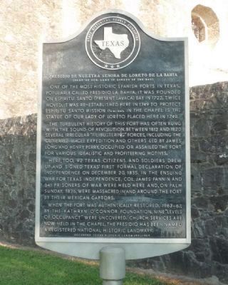
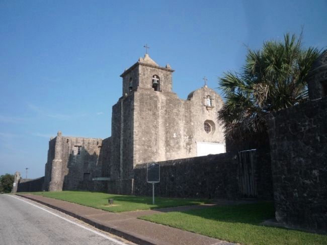
One of the most historic Spanish forts in Texas. Popularly called Presidio la Bahía, it was founded on Espíritu Santo (present Lavaca) Bay in 1722. Twice moved, it was re-established here in 1749 to protect Espiritu Santo Mission (1/4 mi. NW). In the chapel is the statue of Our Lady of Loreto placed here in 1749.
The turbulent history of this fort has often rung with the sound of revolution. Between 1812 and 1820 several irregular "filibustering" forces, including the Gutierrez-Magee Expedition and others led by James Long and Henry Perry, occupied or assailed the fort for various idealistic and profiteering motives.
Here, too, 92 Texas citizens and soldiers drew up and signed Texas' first formal Declaration of Independence on December 20, 1835. In the ensuing War for Texas Independence, Col. James Fannin and 341 prisoners of war were held and, on Palm Sunday, 1836, were massacred in and around the fort by their Mexican captors.
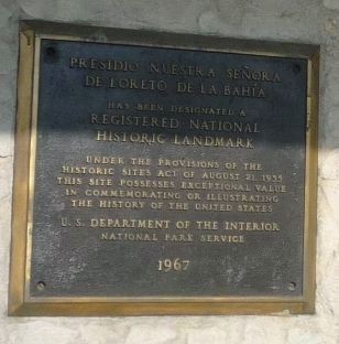
When the fort was authentically restored, 1963-67, by the Kathryn O'Connor Foundation, nine "levels of occupancy" were uncovered. Church services are now held in the chapel. The presidio has been named a Registered National Historic Landmark.
Recorded Texas Historic Landmark--1969
Erected 1969 by State Historical Survey Committee . (Marker Number 4119.)
Topics and series. This historical marker is listed in these topic lists: Churches & Religion • Colonial Era • Forts and Castles • War, Texas Independence. In addition, it is included in the El Camino Real de los Tejas National Historic Trail, and the National Historic Landmarks series lists. A significant historical month for this entry is December 1842.
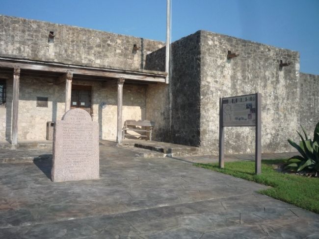
Location. 28° 38.895′ N, 97° 22.97′ W. Marker is in Goliad, Texas, in Goliad County. Marker is on Camino de Bexar east of Calle Cinco de Mayo. Marker is in front of the chapel, outside of the presidio's north wall. The presidio is south of the San Antonio River and Goliad State Park - accessible off Spur 71 east of S. Jefferson Street (U.S. Hwy. 183/77Alt). Touch for map. Marker is in this post office area: Goliad TX 77963, United States of America. Touch for directions.
Other nearby markers. At least 8 other markers are within walking distance of this marker. The Death of Colonel Fannin (within shouting distance of this marker); A Stroke of Very Good Luck (within shouting distance of this marker); Nine Flags Over Goliad (within shouting distance of this marker); Replica of Texas Independence Flagpole (within shouting distance of this marker); Presidio la Bahia del Espíritu Santo de Zúñiga (within shouting distance of this marker); Presidio La Bahía
(within shouting distance of this marker); Manuel Becerra (within shouting distance of this marker); General Ignacio Zaragoza (about 300 feet away, measured in a direct line). Touch for a list and map of all markers in Goliad.
Also see . . . Presidio La Bahía. (Submitted on September 30, 2010, by Richard E. Miller of Oxon Hill, Maryland.)
Additional keywords. New Spain; Our Lady of Loreto Chapel (1779).
Credits. This page was last revised on October 27, 2023. It was originally submitted on September 27, 2010, by Richard E. Miller of Oxon Hill, Maryland. This page has been viewed 1,546 times since then and 21 times this year. Photos: 1, 2. submitted on September 27, 2010, by Richard E. Miller of Oxon Hill, Maryland. 3. submitted on September 28, 2010, by Richard E. Miller of Oxon Hill, Maryland. 4. submitted on September 27, 2010, by Richard E. Miller of Oxon Hill, Maryland. • Bill Pfingsten was the editor who published this page.


