Winslow in Navajo County, Arizona — The American Mountains (Southwest)
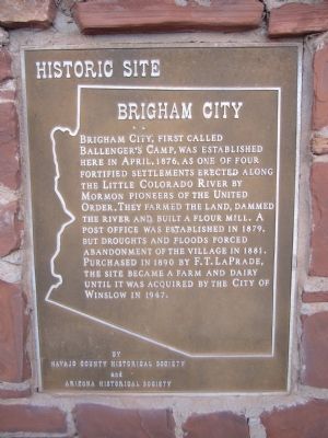
Brigham City
Erected by Navajo County Historical Society and Arizona Historical Society.
Topics. This historical marker is listed in this topic list: Settlements & Settlers. A significant historical month for this entry is April 1876.
Location. 35° 2.479′ N, 110° 41.059′ W. Marker is in Winslow, Arizona, in Navajo County. Marker can be reached from North Road, 0.8 miles east of North Park Drive (exit 253 from I-40). Marker is about 200 feet north from the parking lot along North Park Drive. Touch for map. Marker is in this post office area: Winslow AZ 86047, United States of America. Touch for directions.
Other nearby markers. At least 8 other markers are within 2 miles of this marker, measured as the crow flies. Sunset (approx. 1.4 miles away); General Lot Smith (approx. 1.4 miles away); Winslow Today: Downtown Renaissance and Tourism (approx. 1.4 miles away); Winslow Today: Commerce and Employment (approx. 1.4 miles away); A City in Motion: Modern Modes (approx. 1˝ miles away); A City in Motion: The Heyday of the Santa Fe Railway (approx. 1˝ miles away); The Railroads Build a Town: Early Industry (approx. 1˝ miles away); The Railroads Build a Town: Early Days (approx. 1˝ miles away). Touch for a list and map of all markers in Winslow.
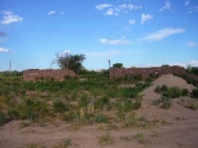
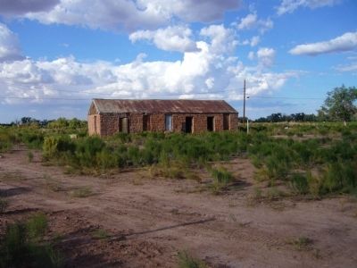
Regarding Brigham City. Many of the stones from the walls at Bringham City were salvaged and used to build the La Posada Hotel.
Credits. This page was last revised on June 16, 2016. It was originally submitted on September 30, 2010, by Bill Kirchner of Tucson, Arizona. This page has been viewed 1,149 times since then and 46 times this year. Photos: 1, 2, 3, 4. submitted on September 30, 2010, by Bill Kirchner of Tucson, Arizona. • Syd Whittle was the editor who published this page.


