Goliad in Goliad County, Texas — The American South (West South Central)
Manuel Becerra
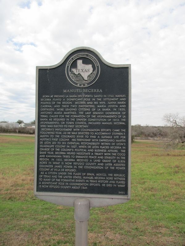
Born at Presidio La Bahía del Espíritu Santo in 1762, Manuel Becerra played a significant role in the settlement and politics of the region. Becerra and his wife, Juana María Cadena, and their two daughters, María Josefa and Gertrudis, were leading citizens of La Bahía. In 1820, Antonio María Martínez, the last Spanish governor of Texas, called for the formation of the ayuntamiento of La Bahía as required in the Spanish Constitution of 1812. The ayuntamiento, or town council, included Manuel Becerra, who was elected its first secretary.
Becerra's involvement with colonization efforts came the following year, as he was selected to accompany Stephen F. Austin to the Colorado River to find a suitable site for Austin's first colony. His friendship with empresario Martín de León led to his eventual responsibility within de León's Guadalupe Colony in 1827, when de León placed Becerra in charge of the colony's political and business affairs. The same year, Becerra helped negotiate a treaty with the Coco and Karankawa tribes to enhance peace and stability in the region. In 1832, Becerra received a land grant of 8,856 acres in what is now Refugio County and later assisted colonizer James Power in the colonization of the Power Colony at Villa de Refugio.
As a citizen under the flags of Spain, Mexico, the Republic of Texas and the United States, Manuel Becerra bore witness to many of the formative events in Texas history and played a significant role in colonization efforts. He died in what is now Refugio County about 1849.
Erected 2001 by Texas Historical Commission. (Marker Number 12499.)
Topics. This historical marker is listed in these topic lists: Colonial Era • Government & Politics • Hispanic Americans • Settlements & Settlers. A significant historical year for this entry is 1762.
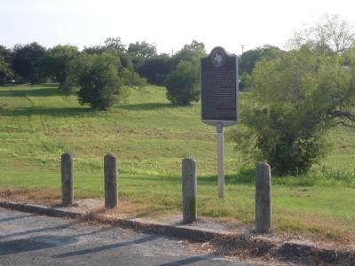
Location. 28° 38.859′ N, 97° 22.992′ W. Marker is in Goliad, Texas, in Goliad County. Marker is on Calle Cinco de Mayo south of Camino de Bexar, on the right when traveling south. Marker is on Calle Cinco de Mayo south of Camino de Bexar and across the street from the south end of the presidio's west wall. The presidio is south of the San Antonio River and Goliad State Park - accessible off Spur 71 east of S. Jefferson Street (U.S. Hwy. 183/77Alt). Touch for map. Marker is in this post office area: Goliad TX 77963, United States of America. Touch for directions.
Other nearby markers. At least 8 other markers are within walking distance of this marker. Presidio La Bahía (a few steps from this marker); General Ignacio Zaragoza (within shouting distance of this marker); Presidio la Bahia del Espíritu Santo de Zúñiga (within shouting distance of this marker); Nine Flags Over Goliad (within shouting distance of this marker); Welcome to the Ignacio Zaragoza Birthplace / Bienvenido a la Casa Natal de Ignacio Zaragoza (within shouting distance of this marker); Replica of Texas Independence Flagpole (within shouting distance of this marker); A Stroke of Very Good Luck (within shouting distance of this marker); A Strategic Location (within shouting distance of this marker). Touch for a list and map of all markers in Goliad.
Also see . . . Tejanos. (Submitted on October 1, 2010, by Richard E. Miller of Oxon Hill, Maryland.)
Additional keywords. New Spain; Tejano.
Credits. This page was last revised on November 7, 2023. It was originally submitted on September 30, 2010, by Richard E. Miller of Oxon Hill, Maryland. This page has been viewed 2,348 times since then and 46 times this year. Photos: 1. submitted on November 6, 2023, by Jeff Leichsenring of Garland, Texas. 2, 3. submitted on September 30, 2010, by Richard E. Miller of Oxon Hill, Maryland. • Bill Pfingsten was the editor who published this page.


