Mount Pleasant in Jefferson County, Ohio — The American Midwest (Great Lakes)
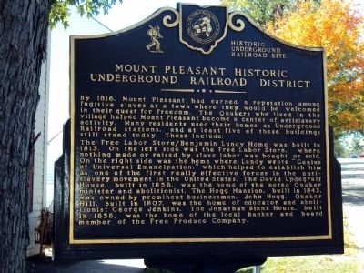
Mount Pleasant Historic Underground Railroad District
Historic Underground Railroad Site
Inscription.
By 1816, Mount Pleasant had earned a reputation among fugitive slaves as a town where they would be welcomed in their quest for freedom. The Quakers who lived in the village helped Mount Pleasant become a center of antislavery activity. Many residents used their homes as Underground Railroad stations, and at least five of these buildings still stand today. These include:
The Free Labor Store/Benjamin Lundy Home was built in 1813. On the left side was the Free Labor Store, where nothing made or raised by slave labor was bought or sold. On the right side was the home where Lundy wrote "Genius of Universal Emancipation," which helped to establish him as one of the first really effective forces in the antislavery movement in the United States. The David Updegraff House, built in 1858, was the home of the noted Quaker minister and abolitionist. The Hogg Mansion, built in 1845, was owned by prominent businessman, John Hogg. Quaker Hill, built in 1807, was the home of educator and abolitionist George Jenkins. The Jonathan Binns House, built in 1858, was the home of the local banker and board member of the Free Produce Company.
Erected by The Friends of Freedom Society and Ohio Underground Railroad Association.
Topics and series. This historical marker is listed in this topic list: Abolition & Underground RR . In addition, it is included in the Quakerism series list. A significant historical year for this entry is 1816.
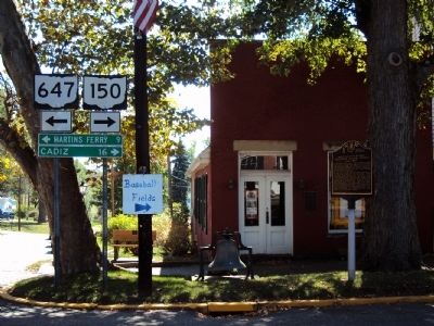
Location. 40° 10.523′ N, 80° 48.035′ W. Marker is in Mount Pleasant, Ohio, in Jefferson County. Marker is at the intersection of Ohio Route 647 and Concord Street, on the right when traveling east on State Route 647. Touch for map. Marker is at or near this postal address: 328 Union Street, Mount Pleasant OH 43939, United States of America. Touch for directions.
Other nearby markers. At least 8 other markers are within walking distance of this marker. Mount Pleasant Veterans Memorial (here, next to this marker); World Wars I and II Memorial (within shouting distance of this marker); Elizabeth House Mansion (about 500 feet away, measured in a direct line); Mt. Pleasant High School (about 600 feet away); Samuel Gill House (about 700 feet away); Benjamin Lundy Home / Free Labor Store (approx. 0.2 miles away); Birthplace of Moses Fleetwood Walker (approx. 0.2 miles away); Free Labor Store / Benjamin Lundy House (approx. 0.2 miles away). Touch for a list and map of all markers in Mount Pleasant.
More about this marker. The marker sits in front of the Mount Pleasant Historical Center.
Credits. This page was last revised on June 16, 2016. It was originally submitted on October 1, 2010, by Jamie Abel of Westerville, Ohio. This page has been viewed 1,878 times since then and 67 times this year. Photos: 1, 2. submitted on October 1, 2010, by Jamie Abel of Westerville, Ohio. • Bill Pfingsten was the editor who published this page.

