Centennial Hill in Montgomery in Montgomery County, Alabama — The American South (East South Central)
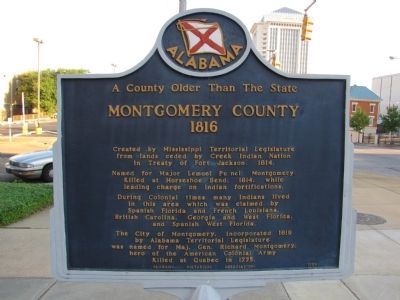
A County Older Than the State
Montgomery County
— 1816 —
Created by Mississippi Territorial Legislature from lands ceded by Creek Indian Nation in Treaty of Fort Jackson, 1814.
Named for Major Lemuel Purnell Montgomery, killed at Horseshoe Bend, 1814, while leading charge on Indian fortifications.
During Colonial times many Indians lived in this area which was claimed by Spanish Florida and French Louisiana, British Carolina, Georgia and West Florida, and Spanish West Florida.
The City of Montgomery, incorporated 1819 by Alabama Territorial Legislature, was named for Maj. Gen. Richard Montgomery, hero of the American Colonial Army, killed at Quebec in 1775.
Erected 1959 by Alabama Historical Association.
Topics and series. This historical marker is listed in these topic lists: Government & Politics • Patriots & Patriotism • Settlements & Settlers. In addition, it is included in the Alabama Historical Association series list. A significant historical year for this entry is 1814.
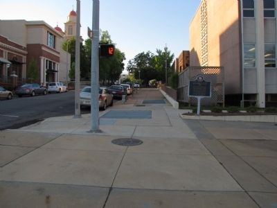
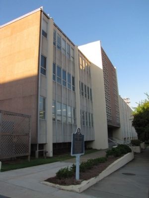
Location. 32° 22.568′ N, 86° 18.378′ W. Marker is in Montgomery, Alabama, in Montgomery County. It is in Centennial Hill. Marker is at the intersection of South Lawrence Street and Washington Avenue, on the right when traveling south on South Lawrence Street. Located adjacent to the Montgomery County courthouse annex. Touch for map. Marker is at or near this postal address: 101 S Lawrence St, Montgomery AL 36104, United States of America. Touch for directions.
Other nearby markers. At least 8 other markers are within walking distance of this marker. Montgomery County Circuit Court / Sit-Ins and Marches at the Montgomery County Courthouse (here, next to this marker); Confederate States of America (CSA) Post Office Department (within shouting distance of this marker); St. Peter's Roman Catholic Church (about 300 feet away, measured in a direct line); Montgomery County Korean War Veterans (about 300 feet away); Dr. J. Marion Sims (about 300 feet away); Office of Dr. Luther Leonidas Hill / Office Site of Dr. J. Marion Sims (about 300 feet away); Chris’ Hot Dogs (about 500 feet away); The Capital City Guards (about 500 feet away). Touch for a list and map of all markers in Montgomery.
Credits. This page was last revised on July 17, 2023. It was originally submitted on October 5, 2010, by Lee Hattabaugh of Capshaw, Alabama. This page has been viewed 1,019 times since then and 20 times this year. Photos: 1, 2, 3. submitted on October 5, 2010, by Lee Hattabaugh of Capshaw, Alabama. • Craig Swain was the editor who published this page.


