Marker Logo HMdb.org THE HISTORICAL
MARKER DATABASE
“Bite-Size Bits of Local, National, and Global History”
Near Henning in Lauderdale County, Tennessee — The American South (East South Central)
 

Union Artillery 12 Pound Howitzers


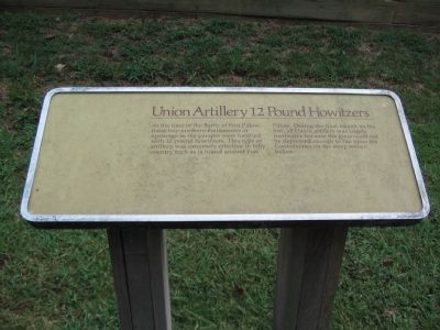
Union Artillery 12 Pound Howitzers Marker image. Click for full size.
Photographed By Craig Swain, September 1, 2010
1. Union Artillery 12 Pound Howitzers Marker
Inscription. At the time of the Battle of Fort Pillow, these two northern embrasures or openings in the parapet were fortified with 12 pound howitzers. This type of artillery was extremely effective in hilly country such as is found around Fort Pillow. During the final assault on the fort, all Union artillery was largely ineffective because the guns could not be depressed enough to fire upon the Confederates on the steep terrain below.
 
Topics. This historical marker is listed in this topic list: War, US Civil.
 
Location. 35° 38.696′ N, 89° 50.254′ W. Marker is near Henning, Tennessee, in Lauderdale County. Marker can be reached from Park Road (State Highway 207), on the right when traveling north. Located in the reconstructed fort in Fort Pillow State Park. The fort is reached by a mile long trail from the visitor center. Touch for map. Marker is in this post office area: Henning TN 38041, United States of America. Touch for directions.
 
Other nearby markers. At least 8 other markers are within walking distance of this marker. Union Artillery 6 Pound James Rifles (within shouting distance of this marker); Union Artillery 10 Pound Parrotts (about 300 feet away, measured in a direct line); Earthworks Over River Batteries (about 300 feet away); Confederate Water Batteries (about 400 feet away); General N.B. Forrest's Command Position
Paid Advertisement
Click on the ad for more information.
Please report objectionable advertising to the Editor.
Click or scan to see
this page online
(approx. ¼ mile away); Inner Breastworks (approx. 0.3 miles away); Confederate Sharpshooters (approx. 0.3 miles away); Outer Breastworks (approx. 0.7 miles away). Touch for a list and map of all markers in Henning.
 
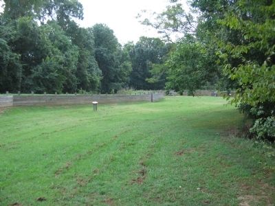
Interior of the Fort and Marker image. Click for full size.
Photographed By Craig Swain, September 1, 2010
2. Interior of the Fort and Marker
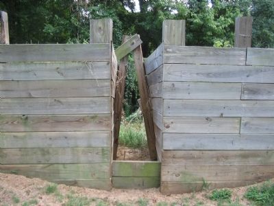
Embrasure in Fort Wall image. Click for full size.
Photographed By Craig Swain, September 1, 2010
3. Embrasure in Fort Wall
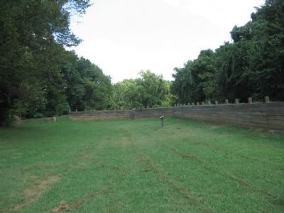
Interior of Fort and Marker image. Click for full size.
Photographed By Craig Swain, September 1, 2010
4. Interior of Fort and Marker
On the north end of the fort are two gun positions.
 
 
Credits. This page was last revised on October 15, 2021. It was originally submitted on October 10, 2010, by Craig Swain of Leesburg, Virginia. This page has been viewed 639 times since then and 6 times this year. Photos:   1, 2, 3, 4. submitted on October 10, 2010, by Craig Swain of Leesburg, Virginia.
Share this page.  
Share on Tumblr
m=36766

CeraNet Cloud Computing sponsors the Historical Marker Database.
This website earns income from purchases you make after using our links to Amazon.com. We appreciate your support.
Paid Advertisement
Apr. 17, 2024