Stillwater in Saratoga County, New York — The American Northeast (Mid-Atlantic)
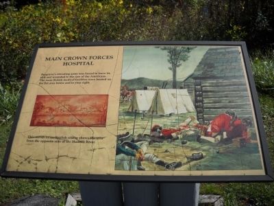
Main Crown Forces Hospital
Erected by National Park Service.
Topics. This historical marker is listed in this topic list: War, US Revolutionary.
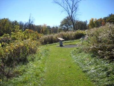
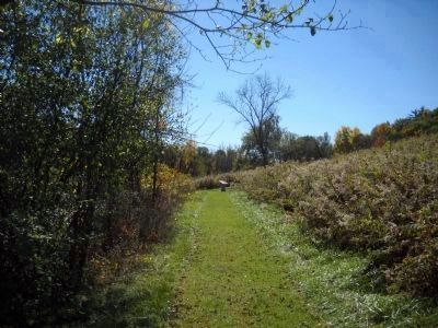
Location. 43° 0.083′ N, 73° 36.543′ W. Marker is in Stillwater, New York, in Saratoga County. Marker can be reached from Park Tour Road, on the right when traveling west. Marker is in Saratoga National Historic Park, on a walking trail that begins at the Fraser Burial Site stop on the auto tour road. Touch for map. Marker is in this post office area: Stillwater NY 12170, United States of America. Touch for directions.
Other nearby markers. At least 8 other markers are within walking distance of this marker. Burgoyne’s Retreat (about 300 feet away, measured in a direct line); Readying to Retreat (about 300 feet away); Crown Forces Artillery Park (about 500 feet away); Crown Forces Baggage Park (approx. 0.2 miles away); Burial Site of General Fraser (approx. 0.2 miles away); The Great Redoubt (approx. 0.2 miles away); Surviving Portion of Champlain Canal (approx. ¼ mile away); Site of the Taylor Cabin (approx. 0.3 miles away). Touch for a list and map of all markers in Stillwater.
More about this marker. The right side of the marker contains a picture of wounded British soldiers being treated at the hospital site. The left of the marker features a picture of a landscape and indicates the positions of the marker, the Hospital, Artillery Park and Baggage Park. It has a caption of “This sketch by an English officer shows the area from the opposite side of the Hudson River.”
Also see . . .
1. Saratoga National Historic Park. National Park Service. (Submitted on October 10, 2010, by Bill Coughlin of Woodland Park, New Jersey.)
2. The Battle of Saratoga (Second)/Bemis Height's. The American Revolutionary War website. (Submitted on October 10, 2010, by Bill Coughlin of Woodland Park, New Jersey.)
3. The Battle of Saratoga 1777. A British perspective of the Battles of Saratoga from BritishBattles.com. (Submitted on October 10, 2010, by Bill Coughlin of Woodland Park, New Jersey.)
Credits. This page was last revised on June 16, 2016. It was originally submitted on October 10, 2010, by Bill Coughlin of Woodland Park, New Jersey. This page has been viewed 668 times since then and 28 times this year. Photos: 1, 2, 3. submitted on October 10, 2010, by Bill Coughlin of Woodland Park, New Jersey.


