Riverside in Baltimore, Maryland — The American Northeast (Mid-Atlantic)
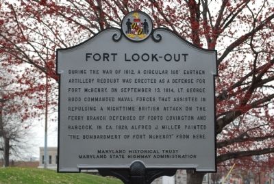
Fort Look-Out
Erected by Maryland Historical Trust, Maryland State Highway Administration.
Topics and series. This historical marker is listed in these topic lists: Forts and Castles • War of 1812. In addition, it is included in the Battlefield Trails - War of 1812, and the Maryland Historical Trust series lists. A significant historical date for this entry is September 13, 1814.
Location. 39° 16.301′ N, 76° 36.495′ W. Marker is in Baltimore, Maryland. It is in Riverside. Marker is at the intersection of East Randall Street and Riverside Avenue, on the right when traveling east on East Randall Street. Touch for map. Marker is in this post office area: Baltimore MD 21230, United States of America. Touch for directions.
Other nearby markers. At least 8 other markers are within walking distance of this marker. Strategic Post (within shouting distance of this marker); Leone Riverside Park (about 400 feet away, measured in a direct line); Raymond R. Allen Court (approx. 0.3 miles away); Holy Cross World War II Memorial (approx. 0.4 miles away); Bethlehem Steel Whirley Crane, 1942 (approx. 0.4 miles away); Platt and Company Oyster Packers (approx. 0.4 miles away); Sailors Union Church (approx. 0.4 miles away); a different marker also named Platt and Company Oyster Packers (approx. 0.4 miles away). Touch for a list and map of all markers in Baltimore.
Credits. This page was last revised on April 17, 2020. It was originally submitted on October 11, 2010, by Chris Nelson of Baltimore, Maryland. This page has been viewed 1,744 times since then and 16 times this year. Photo 1. submitted on October 11, 2010, by Chris Nelson of Baltimore, Maryland. • Bill Pfingsten was the editor who published this page.
