Olde Towne in Portsmouth, Virginia — The American South (Mid-Atlantic)
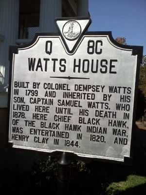
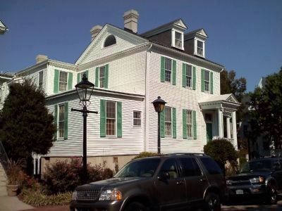
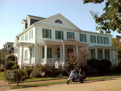
Watts House
Erected 1948 by Virginia Conservation Commission. (Marker Number Q-8C.)
Topics and series. This historical marker is listed in these topic lists: Colonial Era • Government & Politics • Native Americans • Wars, US Indian. In addition, it is included in the Virginia Department of Historic Resources (DHR) series list. A significant historical year for this entry is 1799.
Location. 36° 50.3′ N, 76° 18.133′ W. Marker is in Portsmouth, Virginia. It is in Olde Towne. Marker is at the intersection of 517 North Street and Dinwiddie Street, on the left when traveling east on 517 North Street. Touch for map. Marker is at or near this postal address: 500 North Street, Portsmouth VA 23704, United States of America. Touch for directions.
Other nearby markers. At least 8 other markers are within walking distance of this marker. The Yellow Fever of 1855 (here, next to this marker); Elks Lodge (about 400 feet away, measured in a direct line); Richard Dale, U.S.N. (about 500 feet away); St. John's Church (about 700 feet away); Fort Nelson (about 700 feet away); Olde Towne Portsmouth (about 700 feet away); Arnold's British Defenses, 1781 (about 700 feet away); Lincolnsville (about 700 feet away). Touch for a list and map of all markers in Portsmouth.
Credits. This page was last revised on February 1, 2023. It was originally submitted on October 11, 2010, by James Thomson of Chesapeake, United States. This page has been viewed 955 times since then and 45 times this year. Photos: 1. submitted on October 19, 2010, by James Thomson of Chesapeake, United States. 2, 3. submitted on October 11, 2010, by James Thomson of Chesapeake, United States. • Bill Pfingsten was the editor who published this page.


