Near Milton in Sussex County, Delaware — The American Northeast (Mid-Atlantic)
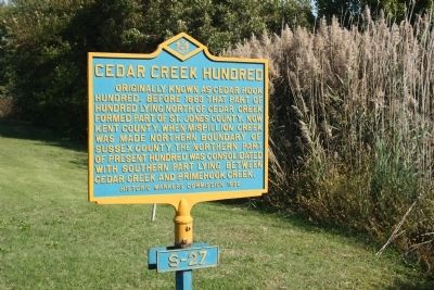
Cedar Creek Hundred
Erected 1932 by Historic Markers Commission. (Marker Number S-27.)
Topics and series. This historical marker is listed in this topic list: Settlements & Settlers. In addition, it is included in the Delaware Public Archives series list. A significant historical year for this entry is 1683.
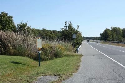
Location. 38° 47.571′ N, 75° 15.286′ W. Marker is near Milton, Delaware, in Sussex County. Marker is on Coastal Highway (Delaware Route 1), on the right when traveling north. On Route 1, east side of highway, just north of Creek. Touch for map. Marker is at or near this postal address: 28465 Paynter Rd, Milton DE 19968, United States of America. Touch for directions.
Other nearby markers. At least 8 other markers are within 3 miles of this marker, measured as the crow flies. Zion United Methodist Church (approx. 1.4 miles away); Mansion Farmer: the David Robbins Homestead (approx. 1.9 miles away); White's Chapel United Methodist Church (approx. 2.2 miles away); Songbirds (approx. 2.2 miles away); History of Prime Hook National Wildlife Refuge (approx. 2.6 miles away); Delaware Bay Initiative (approx. 2.6 miles away); The Morris Cemetery (approx. 2.7 miles away); Wood Ducks (approx. 2.7 miles away). Touch for a list and map of all markers in Milton.
Also see . . . Cedar Creek Hundred. The counties of Delaware were originally divided into Hundreds based on the English use of dividing up counties. On October 25, 1682, William Penn directed that Delaware be divided into hundreds for the purposes of taxation. A "hundred" is an old English Saxon land division which is smaller than a county or shire and larger than a tithing. It comprised ten tithings of ten freeholder families each or one hundred families. The hundreds of Delaware originally served as judicial or legislative districts, but now they remain only as a basis for property tax assessment. (Submitted on October 14, 2010, by Mike Stroud of Bluffton, South Carolina.)
Credits. This page was last revised on March 4, 2024. It was originally submitted on October 14, 2010, by Mike Stroud of Bluffton, South Carolina. This page has been viewed 1,108 times since then and 29 times this year. Photos: 1, 2. submitted on October 14, 2010, by Mike Stroud of Bluffton, South Carolina.

