Near Fredericksburg in Spotsylvania County, Virginia — The American South (Mid-Atlantic)
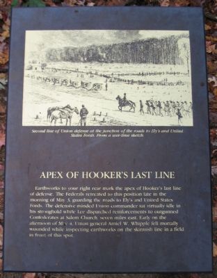
Apex of Hooker’s Last Line
Topics. This historical marker is listed in this topic list: War, US Civil. A significant historical date for this entry is May 3, 1864.
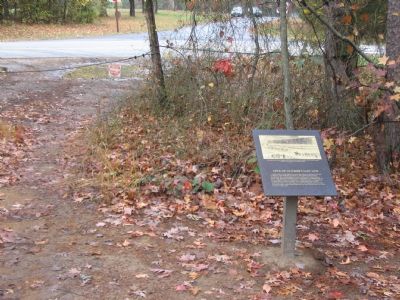
Location. 38° 19.059′ N, 77° 38.241′ W. Marker is near Fredericksburg, Virginia, in Spotsylvania County. Marker is at the intersection of Elys Ford Road (County Route 610) and Bullock Road, on the right when traveling north on Elys Ford Road. Located across the street from the Bullock House Site, stop two of the driving tour of Chancellorsville Battlefield, just off a park service road. Touch for map. Marker is at or near this postal address: 9024 Elys Ford Rd, Fredericksburg VA 22407, United States of America. Touch for directions.
Other nearby markers. At least 8 other markers are within walking distance of this marker. Union Lifeline (within shouting distance of this marker); Hooker's Final Bastion (within shouting distance of this marker); Lives Transformed (about 300 feet away, measured in a direct line); Chancellorsville Campaign (approx. 0.3 miles away); Union Line Contained Along Mineral Springs Road (approx. 0.3 miles away); Stone's Reconnaissance (approx. 0.4 miles away); Union Counterattack (approx. 0.4 miles away); A Midnight Conference (approx. half a mile away). Touch for a list and map of all markers in Fredericksburg.
More about this marker. A drawing, the same used on nearby "Hooker's Final Bastion" marker, displays the "Second line of Union defense at the junction of the roads to Ely's and United States Fords. From a war-time sketch."
Regarding Apex of Hooker’s Last Line. This is one of several markers for the Battle of Chancellorsville at the Bullock House Site, at the apex of Hooker's final line. See the Bullock House Site Virtual Tour by Markers in the links section for a listing of related markers on the tour.
Also see . . .
1. Battle of Chancellorsville. National Park Service site. (Submitted on November 19, 2007, by Craig Swain of Leesburg, Virginia.)
2. Bullock House Site Virtual Tour by Markers. The Bullock House Site portion of the battlefield (stop two on the driving tour of the battlefield) includes markers at the intersection of Bullock and Ely's Ford Roads. The position marked the apex of Hooker's final line. (Submitted on December 8, 2007, by Craig Swain of Leesburg, Virginia.)

Photographed By Craig Swain, November 10, 2007
3. Federal Defensive Line
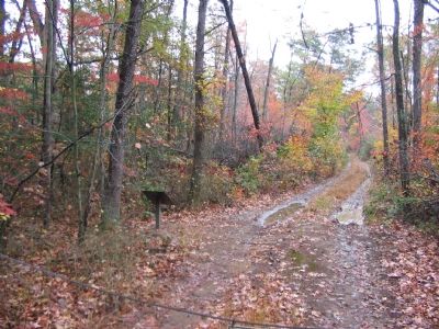
Looking to the east from the marker, the Federal line ran along a ridge line here generally parallel to the service road in this section. Behind the marker is a large, rather un-natural rise, which marks a corner bastion of the Federal works.
Credits. This page was last revised on February 2, 2023. It was originally submitted on November 19, 2007, by Craig Swain of Leesburg, Virginia. This page has been viewed 1,474 times since then and 27 times this year. Photos: 1, 2, 3. submitted on November 19, 2007, by Craig Swain of Leesburg, Virginia.

