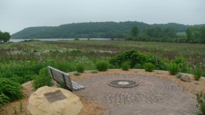
Near Marxville in Dane County, Wisconsin — The American Midwest (Great Lakes)
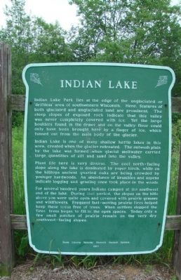
Indian Lake
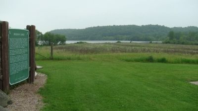
Indian Lake is one of many shallow kettle lakes in this area, created when the glacier retreated. The outwash plain by the lake was formed when glacial meltwater carried large quantities of silt and sand into the valley.
Plant life here is very diverse. The cool north-facing slope along the lake is dominated by paper birch, while on the hilltops ancient gnarled oaks are being crowded by younger hardwoods. An abundance of brambles and aspens indicate logging and grazing once took place in the woods.
For several hundred years Indians camped at the southwest end of the lake. During that period, the slopes on the hills above you were quite open and covered with prairie grasses and wildflowers. Frequent fast-moving prairie fires helped keep these areas free of trees. When settlers stopped the fires, trees began to fill in the open spaces. Today only a few small patches of prairie remain on the very dry southwest-facing slopes.
Erected 1977 by the Dane County Natural History Marker System.
Topics. This historical marker is listed in these topic lists: Native Americans • Natural Features • Settlements & Settlers.
Location. 43° 11.365′ N, 89° 37.297′ W. Marker is near Marxville, Wisconsin, in Dane County. Marker can be reached from the intersection of State Highway 19 and Matz Road, on the left when traveling west. Marker is at the southwest corner of the parking lot at Indian Lake County Park. Touch for map. Marker is in this post office area: Cross Plains WI 53528, United States of America. Touch for directions.
Other nearby markers. At least 8 other markers are within 6 miles of this marker, measured as the crow flies. St. Mary of the Oaks (about 300 feet away, measured in a direct line); The Matz Farmstead (approx. half a mile away); Indian Lake Passage (approx. 0.7 miles away); Kerl School (approx. 4 miles away); Father Adalbert Inama -- St. Norbert House (approx. 5 miles away); In Memory of Rev. Adalbert Inama, O. Praem. (approx. 5.1 miles away); The Plain Good Building of Cross Plains (approx. 5.4 miles away); Haney's Tavern (approx. 5.8 miles away). Touch for a list and map of all markers in Marxville.
Related markers. Click here for a list of markers that are related to this marker. This is a list of markers in the Dane County Natural History Marker System.
Credits. This page was last revised on June 16, 2016. It was originally submitted on June 12, 2010, by William J. Toman of Green Lake, Wisconsin. This page has been viewed 1,354 times since then and 49 times this year. Last updated on October 17, 2010, by William J. Toman of Green Lake, Wisconsin. Photos: 1, 2, 3, 4, 5. submitted on June 12, 2010, by William J. Toman of Green Lake, Wisconsin. • Bill Pfingsten was the editor who published this page.
