Near Richmond in Chesterfield County, Virginia — The American South (Mid-Atlantic)
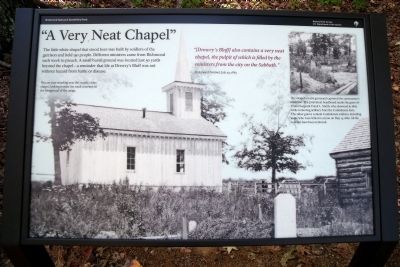
"A Very Neat Chapel"
“[Drewry’s Bluff] also contains a very neat chapel, the pulpit of which is filled by the ministers from the city on the Sabbath.”
Richmond Sentinel, July 29, 1863
Erected 2010 by Richmond National Battlefield Park.
Topics. This historical marker is listed in these topic lists: Cemeteries & Burial Sites • Churches & Religion • War, US Civil. A significant historical month for this entry is July 1836.
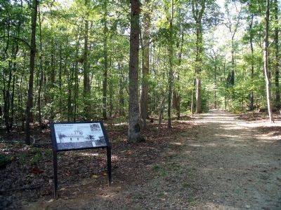
Location. 37° 25.339′ N, 77° 25.357′ W. Marker is near Richmond, Virginia, in Chesterfield County. Marker can be reached from Fort Darling Road, half a mile north of Bellwood Road. This marker is located in the Drewry’s Bluff (Fort Darling) unit of Richmond National Battlefield Park. Touch for map. Marker is at or near this postal address: 7600 Fort Darling Road, Richmond VA 23237, United States of America. Touch for directions.
Other nearby markers. At least 8 other markers are within walking distance of this marker. The First Marine Medal of Honor (within shouting distance of this marker); A Permanent Post (within shouting distance of this marker); Hot Shot and Wooden Ships (within shouting distance of this marker); A Perfect Gibraltar (within shouting distance of this marker); The USS Monitor (within shouting distance of this marker); Drewry’s Bluff (within shouting distance of this marker); Finishing Fort Drewry (within shouting distance of this marker); Fort Darling (about 300 feet away, measured in a direct line). Touch for a list and map of all markers in Richmond.
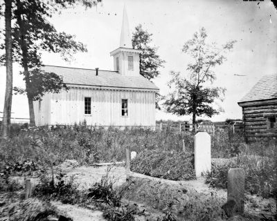
More about this marker. On the left is a period photograpgh of the church with the caption, "You are now standing near the steeple of the chapel, looking toward the small cemetery in the foreground of the image."
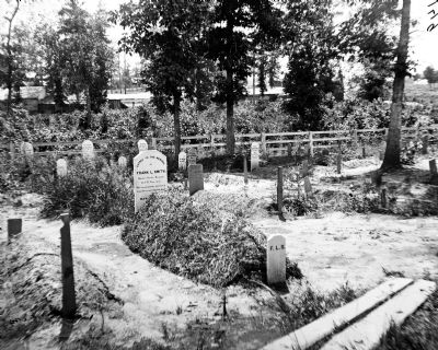
The insert contains a photograph of the cemetery with the caption, "The chapel’s rustic graveyard captured the cameraman’s attention. The prominent headboard marks the grave of Union Sergeant Frank L. Smith, who drowned in 1865 while removing artillery from the Confederate forts. The other graves contain Confederate soldiers, including some who were killed in action on May 15, 1862. All the remains have been removed."
Also see . . .
1. Drewry's Bluff. Richmond National Battlefield Park (Submitted on October 18, 2010, by Bernard Fisher of Richmond, Virginia.)
2. Drewry’s Bluff. Civil War Richmond (Submitted on May 14, 2012, by Bernard Fisher of Richmond, Virginia.)
Credits. This page was last revised on June 16, 2016. It was originally submitted on October 18, 2010, by Bernard Fisher of Richmond, Virginia. This page has been viewed 1,061 times since then and 30 times this year. Photos: 1, 2, 3, 4. submitted on October 18, 2010, by Bernard Fisher of Richmond, Virginia.


