Near Richmond in Chesterfield County, Virginia — The American South (Mid-Atlantic)
Drewry’s Bluff
Captain John Smith’s Adventures on the James
— www.johnsmithtrail.org —
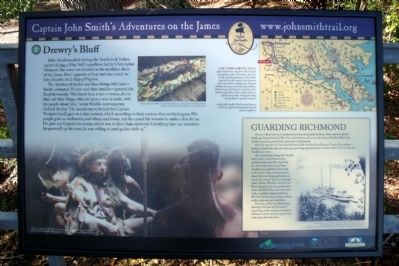
The Arrohateck leader and those living with him—Smith estimated 30 men and their families—greeted the English warmly. “We found here a wer-o-wance, for so they call their Kings, who sat upon a mat of reeds, with his people about him,” wrote Smith’s contemporary Gabriel Archer. “He caused one to be laid for Captain Newport [and] gave us a deer roasted, which according to their custom they seethed again. His people gave us mulberries, sod wheat, and beans; and he caused his women to make cakes for us. He gave our Captain his crown, which was of deer’s hair, dyed red. Certifying him our intention [to proceed] up the river, he was wiling to send guides with us.”
Capt. John Smith’s Trail
John Smith knew the James River by its Algonquian name: Powhatan, the same as the region’s paramount chief. Smith traveled the river many times between 1607 and 1609, trading with Virginia Indians to ensure survival at Jamestown. What he saw of Virginia’s verdant woodlands and pristine waters inspired him to explore the greater Chesapeake Bay, chronicling its natural wonders.
(sidebar)
Guarding Richmond
Drewry’s Bluff and the Confederate fort here dominated the James River and the adjacent landscape during the Civil War. One mile farther south, across the river at Chaffin’s Bluff, other fortifications also guarded the approaches to Richmond.
Directly opposite the fort, extensive farm fields stretched into Henrico County. Two military bridges spanned the river just upstream, providing important access to both sides of the river for the Confederate army.
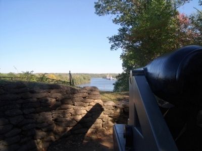
On a typical day during the war, the troops here could observe much activity in the river. The schoolship for the Confederate States Naval Academy lay anchored a few yards to the north. Ships steamed up and down the river bringing prisoners of war to the neutral “point of exchange” south of here. Warships of the James River Squadron often lay in the river below the bluff. One small ship made daily roundtrips between Drewry’s Bluff and Richmond, carrying military traffic, sightseers and picnickers.
The force at Drewry’s Bluff rarely exceeded 500 men and fluctuated depending on the number of marines and naval cadets who were present for instruction and education.
Erected by Captain John Smith’s Trail, James River Association, Virginia Department of Conservation
and Recreation, Chesapeake Bay Gateways Network. (Marker Number 7.)
Topics. This historical marker is listed in these topic lists: Exploration • Native Americans • War, US Civil. A significant historical month for this entry is May 1607.
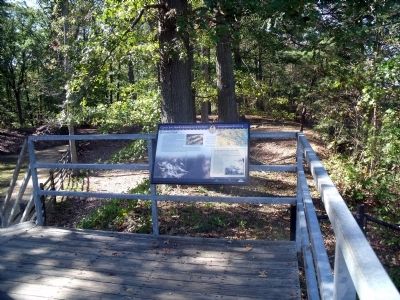
Location. 37° 25.33′ N, 77° 25.305′ W. Marker is near Richmond, Virginia, in Chesterfield County. Marker can be reached from Fort Darling Road, half a mile north of Bellwood Road. This marker is located in the Drewry’s Bluff (Fort Darling) unit of Richmond National Battlefield Park. Touch for map. Marker is at or near this postal address: 7600 Fort Darling Road, Richmond VA 23237, United States of America. Touch for directions.
Other nearby markers. At least 8 other markers are within walking distance of this marker. The USS Monitor (here, next to this marker); Duty Above and Beyond (here, next to this marker); May 15, 1862—The Battle of Drewry's Bluff (a few steps from this marker); Finishing Fort Drewry (within shouting distance of this marker); A Perfect Gibraltar (within shouting distance of this marker); Hot Shot and Wooden Ships (within shouting distance of this marker); "A Very Neat Chapel" (within shouting distance of this marker); The First Marine Medal of Honor (about 300 feet away, measured in a direct line). Touch for a list and map of all markers in Richmond.
Regarding Drewry’s Bluff. On the lower left is a depiction of an Arrohateck Chief and in the center is a photograph of “a deer roasted”. These photos carries the caption, “The New World” © MMV, New Line Productions, Inc. All rights reserved. Photo by Merie Wallace. Photo appears courtesy of New Line Productions, Inc.
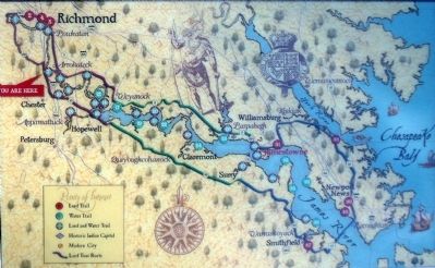
On the upper right is a map Captain John Smith's Trail. The map carries the caption, "Capt. John Smith’s Trail on the James is a 40-site water trail and auto tour for modern explorers."
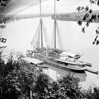
The sidebar contains a Civil War era photograph, "Looking upriver from Drewry’s Bluff in the summer of 1865. Workers haven taken advantage of a calm day on the river to load the ships with Confederate cannon found abandoned at the bluff. Image courtesy Library of Congress."
Also see . . .
1. Captain John Smith’s Trail. (Submitted on October 18, 2010, by Bernard Fisher of Richmond, Virginia.)
2. Drewry's Bluff. Richmond National Battlefield Park (Submitted on October 18, 2010, by Bernard Fisher of Richmond, Virginia.)
3. Drewry’s Bluff. Civil War Richmond (Submitted on May 14, 2012, by Bernard Fisher of Richmond, Virginia.)
Credits. This page was last revised on June 16, 2016. It was originally submitted on October 18, 2010, by Bernard Fisher of Richmond, Virginia. This page has been viewed 1,316 times since then and 35 times this year. Photos: 1, 2, 3, 4, 5. submitted on October 18, 2010, by Bernard Fisher of Richmond, Virginia.
