Near Custer in Custer County, South Dakota — The American Midwest (Upper Plains)
Jasper Fire
Breaking the Records
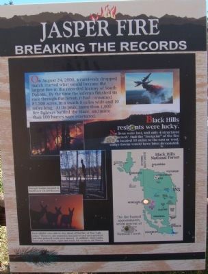
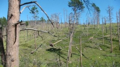
On August 24, 2000, a carelessly dropped match started what would become the largest fire in the recorded history of South Dakota. By the time the inferno finished its race through the forest, it had consumed 83,508 acres, in a swath 8 miles wide and 10 miles long. At its peak, more than 1,000 fire fighters battled the blaze, and more than 100 homes were evacuated.
Black Hills residents were lucky. No lives were lost, and only 4 structures burned. Had the "footprint" of the fire been located 10 miles to the east or west, entire towns would have been devastated.
Caption for map of Black Hills National Forest: The fire burned approximately seven percent of the entire Black Hills National Forest.
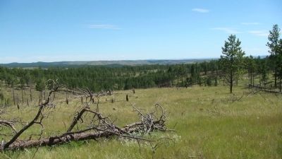
Caption for top two photos: Enough timber burned to build over 18,000 houses.
Caption for lower photo: Most wildlife were able to stay ahead of the fire, or find "safe zones." However, one mountain lion and several deer perished, and nine goshawk nests were burned. In addition, stock tanks, fence and water lines, signs and roads fell victim to the flames.
A Brush that Paints the Landscape
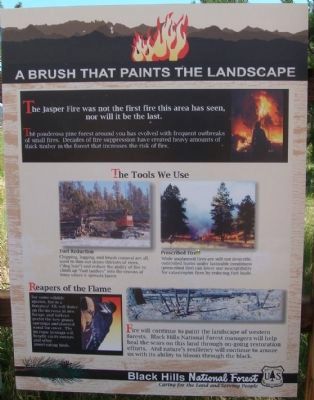
The Jasper Fire was not the first fire this area has seen, nor will it be the last. The ponderosa pine forest around you has evolved with frequent outbreaks of small fires. Decades of fire suppression have created heavy amounts of thick timber in the forest that increases the risk of fire.
The Tools We Use
Caption for upper left photo:
Fuel Reduction
Chipping, logging, and brush removal are all used to thin out dense thickets of trees, ("dog hair") and reduce the ability of fire to climb up "fuel ladders" into the crowns of trees where it spreads faster.
Caption for upper right photo:
Prescribed Fire
While unplanned fires are still not desirable, controlled burns under favorable conditions (prescribed fire) can lower our susceptibility for catastrophic fires by reducing fuel loads.
Reapers of the Flame
Caption for lower left photo:For some wildlife species, fire is a bonanza! Elk will thrive on the increase in new forage, and turkeys prefer the new grassy openings and downed wood for cover. The increase in snags will benefit cavity-nesters and other insect-eating birds.
Fire will continue to paint the landscape of western forests. Black Hills National Forest managers will help heal the scars on this land through on-going restoration efforts. And nature's resiliency will continue to amaze us with its ability to bloom through the black.
Ingredients of an Inferno
At
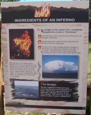
the height of the Jasper Fire, conditions conspired to create a "firestorm."
• Fuel moisture was at record low levels because of drought conditions.
• Strong and gusty winds literally propelled the flames across the landscape.
• The fire grew large enough and hot enough to create its own wind and extend its own life. It acted like a thunderstorm cloud, generating lightning and rain in the center of the Black Hills.
At this point, the raging inferno inhaled trees at an extraordinary rate, burning an area larger than a football field every second. Over 76 square miles were decimated in only a few hours. Dense smoke turned day into night. As far away as Rapid City, lights had to be turned on for a 3:00 p.m. soccer game.
Caption for lower photo:
Fire Designs
The fire completely blackened some areas, leaving ash-covered ground in its wake. Other areas experienced only a light burn, with just the base of the trees scarred. The result was a mosaic pattern typical of many wildland fires.
Erected by the Black Hills National Forest.
Topics. This historical marker is listed in these topic lists: Disasters • Environment. A significant historical year for this entry is 2000.
Location. 43° 43.676′ N, 103° 51.621′ W. Marker is near Custer, South
Dakota, in Custer County. Marker is on Mt. Rushmore Road (U.S. 16) 0.2 miles west of Road 282, on the left when traveling west. Touch for map. Marker is in this post office area: Custer SD 57730, United States of America. Touch for directions.
Other nearby markers. At least 4 other markers are within 8 miles of this marker, measured as the crow flies. Prescribed Fire (approx. 1˝ miles away); Jasper vs. Jewel (approx. 1˝ miles away); Civilian Conservation Corps Camp (approx. 5.9 miles away); Comanche Park (approx. 7.3 miles away).
Credits. This page was last revised on June 16, 2016. It was originally submitted on October 20, 2010, by William J. Toman of Green Lake, Wisconsin. This page has been viewed 1,994 times since then and 73 times this year. Photos: 1, 2, 3, 4, 5, 6, 7. submitted on October 20, 2010, by William J. Toman of Green Lake, Wisconsin. • Bill Pfingsten was the editor who published this page.
