Windsor in Essex County, Ontario — Central Canada (North America)
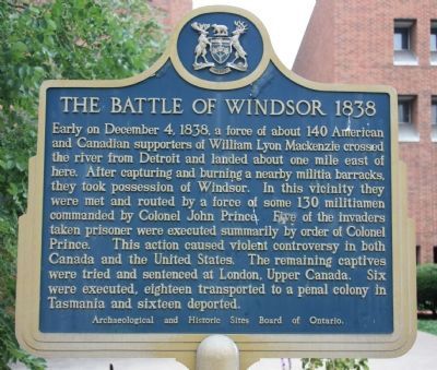
The Battle of Windsor - 1838
Erected by Archaeological and Historic Site Board of Ontario.
Topics. This historical marker is listed in this topic list: Notable Events. A significant historical month for this entry is December 1961.
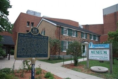
Location. 42° 19.096′ N, 83° 2.547′ W. Marker is in Windsor, Ontario, in Essex County. Marker is on 254 Pitt Street West, 0.2 kilometers east of Dougall Avenue, on the right when traveling west. This historical marker is located in front of the Windsor Community Museum. Touch for map. Marker is in this post office area: Windsor ON N9A 5L5, Canada. Touch for directions.
Other nearby markers. At least 8 other markers are within walking distance of this marker. The Francois Baby House (a few steps from this marker); Mary Ann Shadd Cary (1823-1893) (about 90 meters away, measured in a direct line); The Detroit River (about 180 meters away); French Settlement on the South Shore (approx. 0.3 kilometers away); The Rt. Hon. Herb Gray, PC., C.C., Q.C. (approx. 0.3 kilometers away); Original Home of Major F.A. Tilston V.C. Armoury (approx. 0.4 kilometers away); The Great Western Railway (approx. 0.4 kilometers away); The Underground Railroad in Canada (approx. half a kilometer away). Touch for a list and map of all markers in Windsor.
Also see . . .
1. Battle of Windsor. This is a link to information provided by Wikipedia, the free encyclopedia. (Submitted on October 22, 2010, by Dale K. Benington of Toledo, Ohio.)
2. The Battle of Windsor, 1838 Historical Marker. This is a link to information provided by a web site dedicated to the history of the Detroit area. (Submitted on October 22, 2010, by Dale K. Benington of Toledo, Ohio.)
Credits. This page was last revised on August 16, 2017. It was originally submitted on October 22, 2010, by Dale K. Benington of Toledo, Ohio. This page has been viewed 1,339 times since then and 26 times this year. Photos: 1, 2. submitted on October 22, 2010, by Dale K. Benington of Toledo, Ohio.

