Hannah in Florence County, South Carolina — The American South (South Atlantic)
Hannah
[Front]
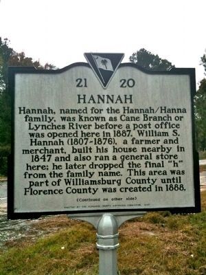
Hannah, named for the Hannah/Hanna family, was known as Cane Branch or Lynches River before a post office was opened here in 1887. William S. Hannah (1807-1876), a farmer and merchant, built his house nearby in 1847 and also ran a general store here; he later dropped the final "h" from the family name. This area was part of Williamsburg County until Florence County was created in 1888.
[Reverse]
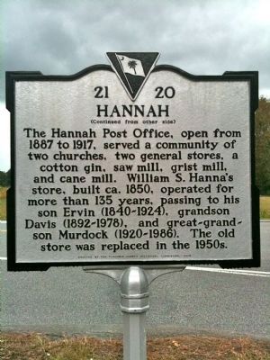
The Hannah Post Office, open from 1887 to 1917, served a community of two churches, two general stores, a cotton gin, saw mill, grist mill, and cane mill. William S. Hanna's store, built ca. 1850, operated for more than 135 years, passing to his son Ervin (1840-1924), grandson Davis (1892-1978), and great-grandson Murdock (1920-1986). The old store was replaced in the 1950s.
Erected 2005 by the Florence County Historical Commission. (Marker Number 21-20.)
Topics and series. This historical marker is listed in these topic lists: Industry & Commerce • Notable Places. In addition, it is included in the Postal Mail and Philately series list. A significant historical year for this entry is 1887.
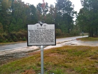
Location. 33° 53.009′ N, 79° 34.675′ W. Marker is in Hannah, South Carolina, in Florence County. Marker is at the intersection of U.S. 378 and Bay Road, on the left when traveling east on U.S. 378. Touch for map. Marker is in this post office area: Pamplico SC 29583, United States of America. Touch for directions.
Other nearby markers. At least 8 other markers are within 8 miles of this marker, measured as the crow flies. Browntown (approx. 4.8 miles away); Marion at Port’s Ferry / Asbury at Port’s Ferry (approx. 7.7 miles away); Dewitt Bluff (approx. 8 miles away); Francis Marion at Witherspoon's Ferry (approx. 8.1 miles away); General Francis Marion (approx. 8.1 miles away); Witherspoon’s Ferry: Francis Marion Takes Command (approx. 8.1 miles away); Johnsonville (approx. 8.1 miles away); Witherspoon’s Ferry / Johnsonville (approx. 8.1 miles away).
Credits. This page was last revised on June 16, 2016. It was originally submitted on October 27, 2010, by David Bullard of Seneca, South Carolina. This page has been viewed 1,341 times since then and 62 times this year. Photos: 1, 2, 3. submitted on October 27, 2010, by David Bullard of Seneca, South Carolina. • Bill Pfingsten was the editor who published this page.


