Sandy in Salt Lake County, Utah — The American Mountains (Southwest)
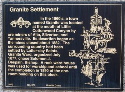
Granite Settlement
Erected 1970 by Daughters of Utah Pioneers. (Marker Number 370.)
Topics and series. This historical marker is listed in these topic lists: Churches & Religion • Industry & Commerce • Settlements & Settlers. In addition, it is included in the Daughters of Utah Pioneers series list. A significant historical year for this entry is 1882.
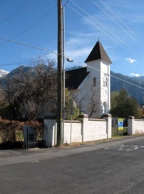
Location. 40° 34.418′ N, 111° 48.332′ W. Marker is in Sandy, Utah, in Salt Lake County. Marker is on South 3100 East south of Granite Woods Lane, on the left when traveling south. Marker is located just north of the old Granite Chapel. Touch for map. Marker is at or near this postal address: 9794 South 3100 East, Sandy UT 84092, United States of America. Touch for directions.
Other nearby markers. At least 8 other markers are within 2 miles of this marker, measured as the crow flies. Welcome to the Temple Quarry Trail (approx. 1.6 miles away); Temple Granite Quarry (approx. 1.6 miles away); Rocky Mountain Goat Lookout (approx. 1.6 miles away); Your Roots (approx. 1.6 miles away); a different marker also named Welcome to the Temple Quarry Trail (approx. 1.6 miles away); Temple Stone Quarry (approx. 1.6 miles away); Temple Quarry Amphitheater (approx. 1.7 miles away); Plugging into Water (approx. 1.7 miles away). Touch for a list and map of all markers in Sandy.
Credits. This page was last revised on April 16, 2019. It was originally submitted on November 1, 2010, by Jack Duffy of West Jordan, Utah. This page has been viewed 1,370 times since then and 81 times this year. Photos: 1, 2, 3. submitted on November 1, 2010, by Jack Duffy of West Jordan, Utah. • Syd Whittle was the editor who published this page.
Editor’s want-list for this marker. Photo of the granite chapel. • Can you help?


