Antioch in Contra Costa County, California — The American West (Pacific Coastal)
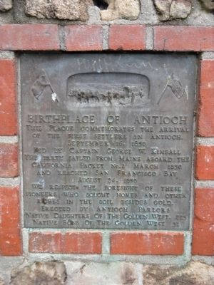
Birthplace of Antioch
of the first settlers in Antioch.
September 16, 1850
Led by Captain George W. Kimball
the party sailed from Maine aboard the
California Packet No.2 March 1850
And reached San Francisco Bay
August 24, 1850
We respect the foresight of these
pioneers who sought homes and other
riches in the soil besides gold.
Erected by Native Daughters of the Golden West, Chapter 223 and Native Sons of the Golden West, Chapter 32.
Topics and series. This historical marker is listed in this topic list: Settlements & Settlers. In addition, it is included in the Native Sons/Daughters of the Golden West series list. A significant historical date for this entry is March 2, 1850.
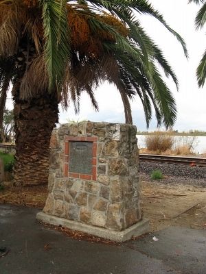
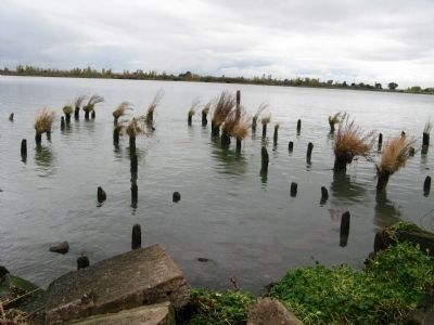
Location. 38° 1.044′ N, 121° 48.75′ W. Marker is in Antioch, California, in Contra Costa County. Marker is on F Street north of West 2nd Street. Marker is located at the end of the street at the San Joaquin River. Touch for map. Marker is in this post office area: Antioch CA 94509, United States of America. Touch for directions.
Other nearby markers. At least 8 other markers are within walking distance of this marker. F & AM - Antioch-Brentwood Lodge #175 Building (about 300 feet away, measured in a direct line); The Woman's Club of Antioch (approx. 0.2 miles away); The Cannery Lady (approx. ¼ mile away); City of Antioch War Dog Memorial (approx. 0.4 miles away); Antioch Fibreboard Company (approx. 0.4 miles away); July 4, Anno Domini, 1951 (approx. 0.6 miles away); Contra Costa County World War I Memorial (approx. 0.7 miles away); The McCoy Cook House (approx. ¾ mile away). Touch for a list and map of all markers in Antioch.
Regarding Birthplace of Antioch. Twin brothers William and Joseph Smith were born in New Hampshire in 1811. They were both ordained ministers in the Christian Church and both were talented carpenters. They immigrated with their families to California in 1849. The Smith brothers went to work in a settlement called New York of the Pacific, now known as Pittsburg. They were able to obtain two quarter-sections of land where Antioch now stands and set up shop. They often went to Smith’s Landing, which it was then known as, to cut firewood for the hotel they opened called The Smith House. Joseph died the following February from malaria.
The following summer a group of New Englanders arrived on the California Packet from Maine. Having heard of their arrival and their desire to start a
colony in California, William went to San Francisco, met them, and invited them to come to Smith’s Landing. Many members of the group preferred the call of the gold fields, but a number accepted the invitation.
On July 4,1851 at what is now the 600 block of 2nd Street, a picnic at the home of William Smith was held. Naming the town was the talk of the day. Several suggestions were made and Antioch was chosen because “at Antioch, the followers of Christ were first called Christians.”
Although many of Antioch’s old buildings have succumbed to fire or the ravages of time, the area known as Old Town can still be seen, bordered by E and I Streets, 6th Street and the San Joaquin River.
Credits. This page was last revised on February 18, 2022. It was originally submitted on November 5, 2010, by Syd Whittle of Mesa, Arizona. This page has been viewed 1,297 times since then and 44 times this year. Photos: 1, 2, 3. submitted on November 5, 2010, by Syd Whittle of Mesa, Arizona.


