Wappingers Falls in Dutchess County, New York — The American Northeast (Mid-Atlantic)
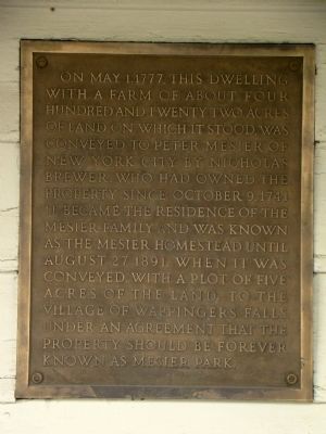
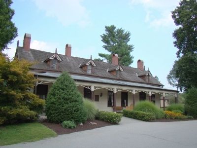
Mesier Park
Topics. This historical marker is listed in this topic list: Notable Buildings. A significant historical month for this entry is May 1963.
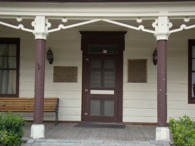
Location. 41° 35.883′ N, 73° 55.033′ W. Marker is in Wappingers Falls, New York, in Dutchess County. Marker can be reached from the intersection of East Main Street (New York State Route 9D) and South Avenue (New York State Route 9D), on the right when traveling north. It is attached to the house, to the right of the front door. Touch for map. Marker is in this post office area: Wappingers Falls NY 12590, United States of America. Touch for directions.
Other nearby markers. At least 8 other markers are within 4 miles of this marker, measured as the crow flies. A different marker also named Mesier Park (about 300 feet away, measured in a direct line); Estate Owned and Occupied 1804-1812 By George Clinton (approx. 1.6 miles away); Wappinger War Memorial (approx. 2.4 miles away); Wappinger 9/11 Memorial (approx. 2.4 miles away); Historic Carnwath Farms (approx. 2˝ miles away); Carnwath Farms (approx. 2.6 miles away); Presbyterian Church & Cemetery (approx. 2.9 miles away); Gomez Mill House (approx. 3.4 miles away). Touch for a list and map of all markers in Wappingers Falls.
Also see . . . Mesier Park & Homestead. “In 1776, a well-to-do loyalist tea merchant from New York City, Peter Mesier, arrived in Fishkill. He bought the 750 acres of land and the homestead from Nicholas Brewer and opened a small store in the homestead. Mesier angered his customers with high prices and in May of 1777, a number of people broke into his store and demanded tea, refusing to pay the high prices asked. For three days, the intruders beat Mesier and his wife and servants, destroyed his property and raided his cellar. Peter Mesier and his wife, Catherine Sleight, lived peacefully after the incident and together had eight children, three boys and five girls.” (Submitted on November 7, 2010.)
Credits. This page was last revised on June 16, 2016. It was originally submitted on November 7, 2010, by J. J. Prats of Powell, Ohio. This page has been viewed 718 times since then and 12 times this year. Photos: 1, 2, 3. submitted on November 7, 2010, by J. J. Prats of Powell, Ohio.


