Downtown Memphis in Shelby County, Tennessee — The American South (East South Central)
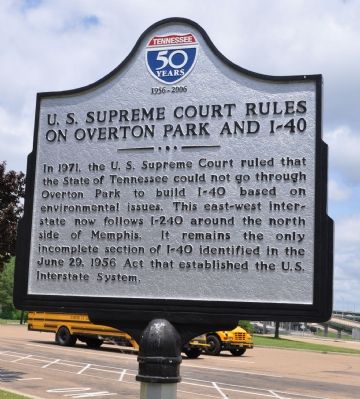
U.S. Supreme Court Rules On Overton Park and I-40
1956 - 2006
Inscription.
In 1971, the U.S. Supreme Court ruled that the State of Tennessee could not go through Overton Park to build I-40 based on environmental issues. This east-west interstate now follows I-240 around the north side of Memphis. It remains the only incomplete section of I-40 identified in the June 29, 1956 Act that established the U.S. Interstate System
Topics. This historical marker is listed in this topic list: Roads & Vehicles. A significant historical month for this entry is June 1926.
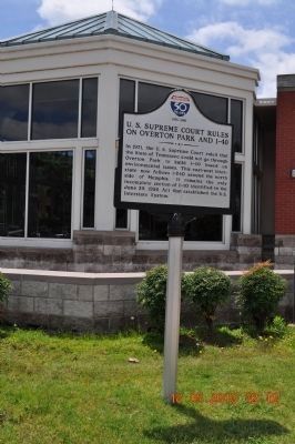
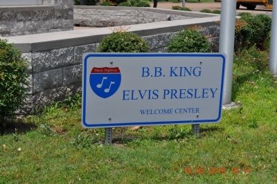
Location. 35° 8.946′ N, 90° 3.281′ W. Marker is in Memphis, Tennessee, in Shelby County. It is in Downtown Memphis. Marker can be reached from Poplar Avenue, on the right when traveling south. Marker is beside the Welcome Center near Mud Island. Touch for map. Marker is in this post office area: Memphis TN 38103, United States of America. Touch for directions.
Other nearby markers. At least 8 other markers are within walking distance of this marker. Civil War in Tennessee (a few steps from this marker); The Sultana Disaster (about 400 feet away, measured in a direct line); Fort Adams, Mississippi/Old River Control Structure/Homochitto Cutoff (about 600 feet away); Mud Island (about 700 feet away); Mississippi River Park (about 700 feet away); Virginia ("Ginnie") Bethel Moon (about 700 feet away); Elizabeth Avery Meriwether (about 700 feet away); Confederate Park (approx. 0.2 miles away). Touch for a list and map of all markers in Memphis.
Also see . . . Citizens to Preserve Overton Park v. Volpe. Wikipedia entry. “During the interstate highway system’s late 1950s and early 1960s building boom, public parks had been viewed as a desirable path. Building through them didn’t require the federal government to use the power of eminent domain. That changed in the mid-1960s, under § 4(f) of the Department of Transportation Act of 1966, a federal statute commonly called ‘Section 4(f).’ It required the government to demonstrate that there were no ‘feasible and prudent’ alternatives to building through public lands. After [Transportation] Secretary Volpe approved the Tennessee Department of Highway’s proposal to construct the highway through Overton Park, a group called Citizens to Preserve Overton Park brought suit against him in the Western District of Tennessee. They claimed that the Secretary had not complied with §4(f) of the Department of Transportation Act” (Submitted on November 14, 2010.)

Photographed By Sandra Hughes, May 18, 2010
3. I-40 Up-ramp to Bridge over Mississippi River
Overton Park, mentioned on the marker, is several blocks east of the welcome center. Even today, no interstate or other limited access highway runs through the middle of Memphis. Instead the I-240 loop circles the city.
Credits. This page was last revised on February 7, 2023. It was originally submitted on November 8, 2010, by Sandra Hughes Tidwell of Killen, Alabama, USA. This page has been viewed 1,733 times since then and 79 times this year. It was the Marker of the Week November 14, 2010. Photos: 1, 2, 3, 4, 5, 6, 7. submitted on November 8, 2010, by Sandra Hughes Tidwell of Killen, Alabama, USA. • Craig Swain was the editor who published this page.
