Kinderhook in Columbia County, New York — The American Northeast (Mid-Atlantic)
Uncovering the Past
Martin Van Buren Natíl Hist Site
ó National Park Service ó
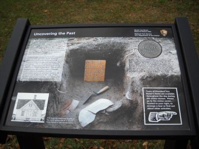
In addition to the written record, archaeological evidence contributes valuable information to our understanding of President Van Burenís farm. This archaeological test pit shows the position and types of objects used by former inhabitants of the north gatehouse which was located on this site. This dig helped us to know what they did, the foods they ate and what other functions took place here.
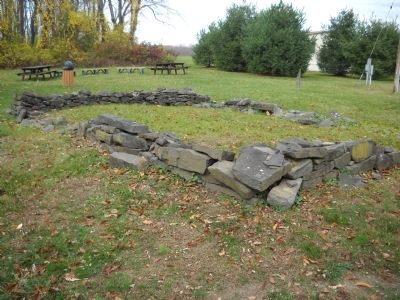
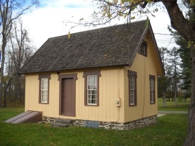
Designed and constructed by local carpenters between 1846 and 1847, nearly identical gatehouses stood at the south and north entrances of the carriage path leading to the main house. The north gatehouse differed having a dormer above the front door which added space to the second floor. This wood framed Gothic Revival structure, complete with its own well and privy, housed Lindenwald employees and their families. In disrepair and dismantled in the early 1950ís, the door and several windows were re-used in a nearby home, where they remain today.
Tours of President Van Burenís home are available throughout the day during the visitor season. Please go to the visitor center, located to your right, to arrange a tour or find out about other activities.
Erected by National Park Service.
Topics and series. This historical marker is listed in this topic list: Notable Places . In addition, it is included in the Former U.S. Presidents: #08 Martin Van Buren series list. A significant historical year for this entry is 1846.
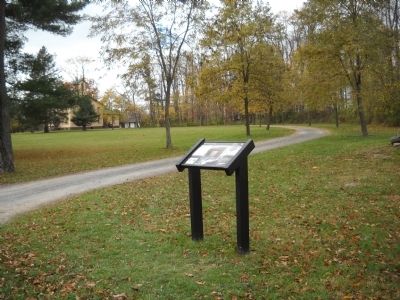
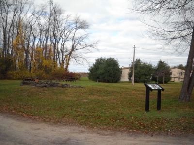
Location. 42° 22.225′ N, 73° 42.132′ W. Marker is in Kinderhook, New York, in Columbia County. Marker is on Old Post Road, on the right when traveling south. Marker is on the grounds of the Martin Van Buren National Historic Site. Touch for map. Marker is in this post office area: Kinderhook NY 12106, United States of America. Touch for directions.
Other nearby markers. At least 8 other markers are within walking distance of this marker. Welcome to Lindenwald (within shouting distance of this marker); Lindenwald and the Old Post Road (about 400 feet away, measured in a direct line); Fertile Political Ground (about 400 feet away); 1849-50 † † A House Transformed (about 500 feet away); A Bustling Household (about 500 feet away); Marble Mounting Block (about 500 feet away); Lindenwald (about 500 feet away); Fallen White Mulberry Tree (about 600 feet away). Touch for a list and map of all markers in Kinderhook.
More about this marker. The background of the marker shows the excavation site with artifacts and excavation tools. A picture of a copper token found at the site appears at the markerís upper right. It has a caption of ďBuried in the soil for at least a century and found near here, this weathered copper fruit
token bears the date of 1863. Although this is the year following Martin Van Burenís death, he and other growers used tokens as a promise of payment to pickers and other farmhands for their work in an orchard after the start of the Civil War. The War caused a shortage of coinage across the country. The tokens could be redeemed for cash, in this case, by journeying to 427 Broadway in Albany, New York.Ē The lower left of the marker features a ďdrawing show[ing] the faÁade of the north gatehouse as it would have looked in Van Burenís time.Ē
Also see . . .
1. Biography of Martin Van Buren. The White House website entry (Submitted on November 12, 2010, by Bill Coughlin of Woodland Park, New Jersey.)
2. Martin Van Buren National Historic Site. National Park Service website homepage (Submitted on November 12, 2010, by Bill Coughlin of Woodland Park, New Jersey.)
3. Van Buren, Martin, National Historic Site - National Park Service. Download National Register of Historic Places documentation (Submitted on January 17, 2024, by Anton Schwarzmueller of Wilson, New York.)
Credits. This page was last revised on January 17, 2024. It was originally submitted on November 12, 2010, by Bill Coughlin of Woodland Park, New Jersey. This page has been viewed 603 times since then and 15 times this year. Photos: 1, 2, 3, 4, 5. submitted on November 12, 2010, by Bill Coughlin of Woodland Park, New Jersey.
