Poughkeepsie in Dutchess County, New York — The American Northeast (Mid-Atlantic)
The Queen City of the Hudson
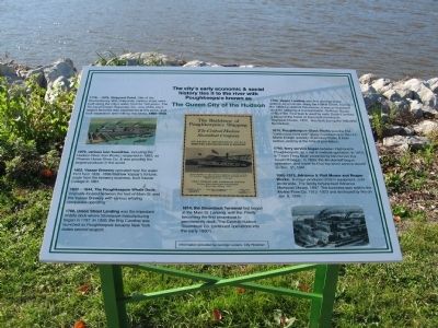
history ties it to the river with
Poughkeepsie known as
The Queen City of the Hudson
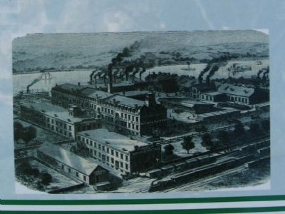
1873, various iron foundries, including the Hudson River Iron Works; reopened in 1883, as Phoenix Horse Shoe Co. & was possibly the largest producer in the world.
1803, Vassar Brewery operated near the water front from 1836 – 1896. Matthew Vassar's fortune, made from the brewery business, built Vassar College in 1861.
1832 – 1844, The Poughkeepsie Whale Dock, originally located between the foot of Main St. and the Vassar Brewery with various whaling companies operating.
1760, Union Street Landing was the important middle dock where Stoneware manufacturing began in 1797. In 1800, the Brig Caroline was launched as Poughkeepsie became New York states second seaport.
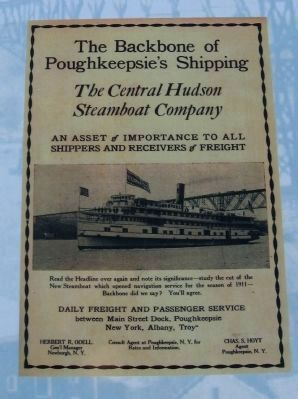
1814, the Steamboat Terminal first began at the Main St. Landing, with the Firefly becoming the first steamboat to permanently dock. The Central Hudson Steamboat Co. continued operations into the early 1900's. 1700, Upper Landing was first used by Dutch settlers as a mill site along the Fallkill Creek. During the 1800's Industrial Revolution, it was an important dock for shipping & transportation. Hoffman House 1740-1780. First built & used by early Dutch Families, it became the home of important merchants. Reynolds House, 1820, was built during the Industrial Revolution.
1879, Poughkeepsie Glass Works was the first "continuous feed tank" glass manufactory in the U.S. Made a large quantity of whiskey flasks & beer bottles, ending at the time of prohibition. 1793, ferry service began between Highland & Poughkeepsie, as a sail and rowboat operation. In 1819, a "Team Ferry Boat" powered by two horses in a treadmill began. In 1899, the Brinkerhoff began operation, and made its final trip when service closed o Dec. 31, 1941.
1865 – 1913, Adriance & Platt Mower And Reaper Works. A major producer of farm equipment, sold worldwide. The family fortune built Adriance Memorial Library, 1897. The business was sold to the Moline Plow Co. 1913 – 1923 and destroyed by fire on Jan. 8, 1939.
Information provided by George Lukacs, City Historian
Topics. This historical marker is listed in this topic list: Industry & Commerce. A significant historical month for this entry is January 1864.
Location.
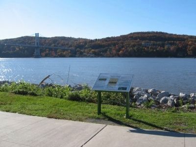
41° 42.475′ N, 73° 56.419′ W. Marker is in Poughkeepsie, New York, in Dutchess County. Marker is at the intersection of Main Street and North Water Street, on the right when traveling west on Main Street. Located in Waryas Memorial Park on the Hudson River. Touch for map. Marker is in this post office area: Poughkeepsie NY 12601, United States of America. Touch for directions.
Other nearby markers. At least 8 other markers are within walking distance of this marker. Walkway Over the Hudson (here, next to this marker); Walkway Loop Trail (here, next to this marker); River That Flows Both Ways (about 600 feet away, measured in a direct line); Poughkeepsie Waterfront (about 600 feet away); Victor C. Waryas Memorial Park (about 700 feet away); Franklin D. Roosevelt Mid-Hudson Bridge (approx. 0.2 miles away); Lange Rack (approx. 0.2 miles away); The Hudson River Day Line (approx. 0.2 miles away). Touch for a list and map of all markers in Poughkeepsie.
Credits. This page was last revised on June 16, 2016. It was originally submitted on November 12, 2010, by Michael Herrick of Southbury, Connecticut. This page has been viewed 1,431 times since then and 24 times this year. Photos: 1, 2, 3, 4. submitted on November 12, 2010, by Michael Herrick of Southbury, Connecticut.


