Near Fredericksburg in Spotsylvania County, Virginia — The American South (Mid-Atlantic)
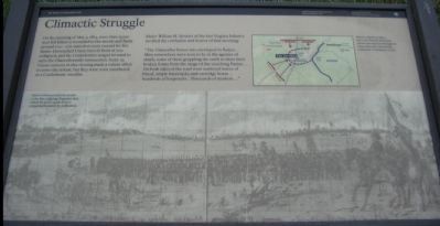
Climactic Struggle
Major William H. Stewart of the 61st Virginia Infantry recalled the confusion and horror of that morning:
"The Chancellor house was enveloped in flames .... Men everywhere were seen to be in the agonies of death, some of these grappling the earth to draw their broken forms from the range of the searching flames. On both sides of the road were scattered loaves of bread, empty haversacks and cartridge boxes... hundreds of knapsacks...thousands of muskets...."
Topics. This historical marker is listed in this topic list: War, US Civil. A significant historical date for this entry is May 3, 1868.
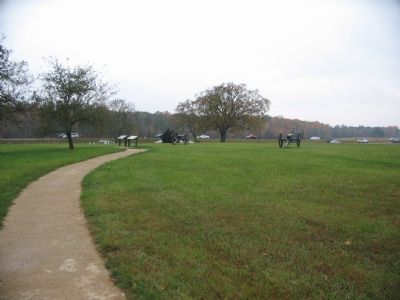
Location. 38° 18.546′ N, 77° 38.089′ W. Marker is near Fredericksburg, Virginia, in Spotsylvania County. Marker is at the intersection of Plank Road / Germania Highway (State Highway 3) and Elys Ford Road (County Route 610), on the right when traveling west on Plank Road / Germania Highway. Located at stop three of the driving tour of Chancellorsville Battlefield. Touch for map. Marker is at or near this postal address: 8840 Elys Ford Rd, Fredericksburg VA 22407, United States of America. Touch for directions.
Other nearby markers. At least 8 other markers are within walking distance of this marker. Lee's Greatest Triumph (here, next to this marker); The Chancellor Slaves (within shouting distance of this marker); Civilians in the Crossfire (within shouting distance of this marker); Chancellorsville (within shouting distance of this marker); The Chancellorsville Intersection (within shouting distance of this marker); Chancellorsville Home of Mrs. Sanford Chancellor (within shouting distance of this marker); Battle of Chancellorsville (within shouting distance of this marker); Chancellorsville Clearing (about 500 feet away, measured in a direct line). Touch for a list and map of all markers in Fredericksburg.
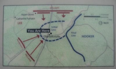
More about this marker. On the lower half of the marker is a drawing showing the artist impression of the fighting around the Chancellorsville Intersection. "Edwin Forbes penciled this sketch of the May 3 fighting. Engravers later added the grid to guide them in preparing the sketch for publication." On the upper right is a map showing the tactical situation described in the text, "Massive attacks on May 3 drove the Federals from their earthworks and back through the Chancellorsville intersection sealing the Confederate victory."
Regarding Climactic Struggle. This is one of several markers for the Battle of Chancellorsville at the Chancellorsville Intersection, scene of considerable fighting in the battle. See the Chancellorsville Intersection Virtual Tour by Markers in the links section for a listing of related markers on the tour.
Also see . . . Chancellorsville Intersection Virtual Tour by Markers. The Chancellorsville Intersection portion of the battlefield (stop three on the driving tour of the battlefield) includes markers at the intersection of the historic Plank and Ely's Ford Roads. Considerable fighting occurred here on May 3, 1863. (Submitted on December 8, 2007, by Craig Swain of Leesburg, Virginia.)

Photographed By Craig Swain, November 10, 2007
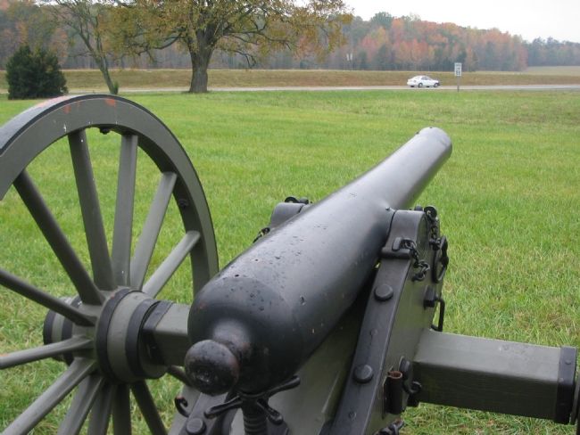
4. The Artillery Crew View of the Battlefield
Fairview lays in the distance to the background right in this view. In this frame, Stuart's and Anderson's converging Confederate lines advanced on the Federal positions near the location of the cannon. The Cannon pictured here is a 3in Ordnance Rifle, Model of 1861. Its registration number is 195, indicating a manufactured date of 1862. Similar weapons, if not this very piece, were deployed at the Chancellorsville intersection during the battle.
Credits. This page was last revised on February 2, 2023. It was originally submitted on November 29, 2007, by Craig Swain of Leesburg, Virginia. This page has been viewed 1,209 times since then and 20 times this year. Photos: 1, 2, 3, 4. submitted on November 29, 2007, by Craig Swain of Leesburg, Virginia.


