Demopolis in Marengo County, Alabama — The American South (East South Central)
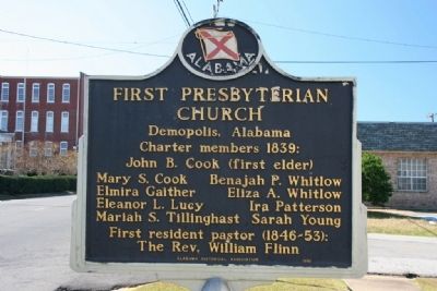
First Presbyterian Church
Demopolis, Alabama
Side A
Charter members 1839:
John B. Cook (first elder)
Mary S. Cook
Elmira Gaither
Eleanor L. Lucy
Mariah S. Tillinghast
Benajah P. Whitlow
Eliza A. Whitlow
Ira Patterson
Sarah Young
First resident pastor (1846-53);
The Rev. William Flinn
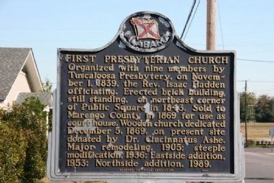
Side B
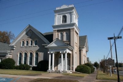
Organized with nine members by Tuscaloosa Presbytery, on November 1, 1839, the Rev. Isaac Hadden officiating. Erected brick building, still standing, on northeast corner of Public Square in 1843. Sold to Marengo County in 1869 for use as court house. Wooden church dedicated December 5, 1869, on present site donated by Dr. Cincinnatus Ashe. Major remodeling, 1905; steeple modification, 1936; Eastside addition, 1953; Northside addition, 1989.
Erected 1990 by Alabama Historical Association.
Topics and series. This historical marker is listed in this topic list: Churches & Religion. In addition, it is included in the Alabama Historical Association series list. A significant historical month for this entry is November 1944.
Location. 32° 31.104′ N, 87° 50.173′ W. Marker is in Demopolis, Alabama, in Marengo County. Marker is at the intersection of East Capitol Street and North Strawberry Avenue, on the right when traveling east on East Capitol Street. Touch for map. Marker is at or near this postal address: 300 North Strawberry Avenue, Demopolis AL 36732, United States of America. Touch for directions.
Other nearby markers. At least 8 other markers are within walking distance of this marker. The Demopolis Theater District (about 400 feet away, measured in a direct line); The Demopolis Opera House / Lillian Hellman And (about 500 feet away); Marengo County Confederate Monument (approx. 0.2 miles away); Alabama Cattlemen’s Association (approx. 0.2 miles away); Trinity Episcopal Church (approx. 0.2 miles away); Temple B’Nai Jeshurun (approx. 0.2 miles away); Bluff Hall (approx. ¼ mile away); White Bluff (approx. 0.3 miles away). Touch for a list and map of all markers in Demopolis.
Credits. This page was last revised on June 16, 2016. It was originally submitted on November 15, 2010, by Timothy Carr of Birmingham, Alabama. This page has been viewed 844 times since then and 25 times this year. Photos: 1, 2, 3, 4. submitted on November 15, 2010, by Timothy Carr of Birmingham, Alabama. • Bill Pfingsten was the editor who published this page.


