El Paso in El Paso County, Texas — The American South (West South Central)
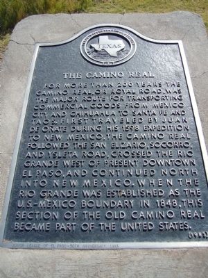
The Camino Real
Erected 1983 by Texas Historical Commission. (Marker Number 642.)
Topics and series. This historical marker is listed in this topic list: Roads & Vehicles. In addition, it is included in the El Camino Real de Tierra Adentro series list. A significant historical year for this entry is 1598.
Location. 31° 45.726′ N, 106° 30.556′ W. Marker is in El Paso, Texas, in El Paso County. Marker is on West Old Paisano Drive, 0.2 miles south of Ruhlen Court, on the right when traveling south. Touch for map. Marker is in this post office area: El Paso TX 79901, United States of America. Touch for directions.
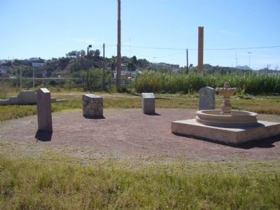
Other nearby markers. At least 8 other markers are within walking distance of this marker. Major Simeon Hart (here, next to this marker); Capt. James W. Magoffin (here, next to this marker); El Paso del Rio del Norte (here, next to this marker); Fort Bliss Officers' Quarters (about 700 feet away, measured in a direct line); Burges House (approx. 0.8 miles away); Old San Francisco Historic District (approx. 0.8 miles away); El Paso Union Passenger Station (approx. 0.9 miles away); Old B'Nai Zion Synagogue (approx. 0.9 miles away). Touch for a list and map of all markers in El Paso.
Credits. This page was last revised on June 11, 2018. It was originally submitted on November 16, 2010, by Bill Kirchner of Tucson, Arizona. This page has been viewed 951 times since then and 41 times this year. Last updated on June 5, 2018, by Brian Anderson of Humble, Texas. Photos: 1, 2. submitted on November 16, 2010, by Bill Kirchner of Tucson, Arizona. • Bill Pfingsten was the editor who published this page.

