Mount Pleasant in Charleston County, South Carolina — The American South (South Atlantic)
Ronkin's Long Room / Ferry Service
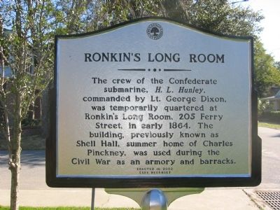
Ronkin's Long Room
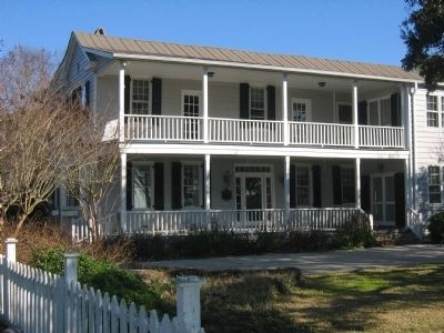
The crew of the Confederate submarine, H.L. Hunley, commanded by Lt. George Dixon, was temporarily quartered at Ronkinís Long Room, 205 Ferry Street, in early 1864. The building, previously known as Shell Hall, summer home of Charles Pinckney, was used during the Civil War as an armory and barracks.
(Reverse):
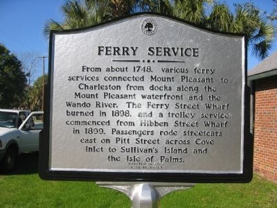
Ferry Service
A ferry service connected Mount Pleasant to Charleston from the wharf at the end of Ferry Street (c. 1847) until the completion of the Cooper River Bridge. Passengers traveled by trolley from Ferry Street east on Pitt Street, across Cove Inlet to Sullivanís Island and across Breach Inlet to the Isle of Palms resort.
Erected 2003 by Town of Mount Pleasant.
Topics. This historical marker is listed in these topic lists: War, US Civil • Waterways & Vessels. A significant historical year for this entry is 1864.
Location. 32° 47.067′ N, 79° 52.375′ W. Marker is in Mount Pleasant, South Carolina, in Charleston County. Marker is on Pitt Street. Touch for map. Marker is in this post office area: Mount Pleasant SC 29464, United States of America. Touch for directions.
Other nearby markers. At least 8 other markers are within walking distance of this marker. Patjens Post Office (within shouting distance of this marker); "Storm of the Century" (about 300 feet away, measured in a direct line); The Old Village (about 300 feet away); Confederate Cemetery / Memorial (about 500 feet away); War of 1812 Encampment (about 500 feet away); Friendship A.M.E. Church (about 600 feet away); Darby Building (about 600 feet away); Laing School (approx. 0.2 miles away). Touch for a list and map of all markers in Mount Pleasant.
Credits. This page was last revised on June 16, 2016. It was originally submitted on November 16, 2010. This page has been viewed 788 times since then and 24 times this year. Photos: 1, 2, 3. submitted on November 16, 2010. 4. submitted on January 5, 2011, by Mike Stroud of Bluffton, South Carolina. 5. submitted on November 16, 2010. • Craig Swain was the editor who published this page.
