Society Hill in Darlington County, South Carolina — The American South (South Atlantic)
Welsh Neck Church
Side A
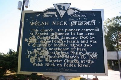
This church, the pioneer center of Baptist influence in the area, was constituted January 1738 by Welsh from Pennsylvania and was originally located about two miles northeast of here. The first pastor was Philip James. It was incorporated March 17, 1785, as the “Baptist Church at the Welsh Neck on Pedee River.”
Side B
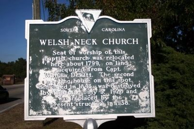
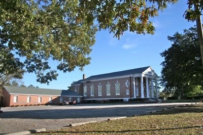
Seat of worship of this Baptist church was relocated here about 1799 on land acquired from Capt. William DeWitt. The second meeting house on this spot, dedicated in 1843, was destroyed by lightning July 5, 1928 and was replaced by the present structure in 1938.
Erected 1976 by Welsh Neck Baptist Church and the Darlington County Historical Commission. (Marker Number 16-13.)
Topics. This historical marker is listed in this topic list: Churches & Religion. A significant historical year for this entry is 1738.
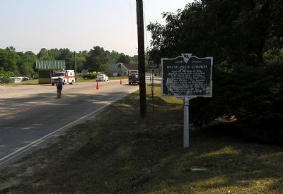
Location. 34° 30.761′ N, 79° 51.041′ W. Marker is in Society Hill, South Carolina, in Darlington County. Marker is at the intersection of Main Street (U.S. 401) and Church Street, on the right when traveling north on Main Street. Touch for map. Marker is at or near this postal address: 112 Church Street, Society Hill SC 29593, United States of America. Touch for directions.
Other nearby markers. At least 8 other markers are within walking distance of this marker. Long Bluff (within shouting distance of this marker); Lawrence Faulkner / Simon Brown (about 400 feet away, measured in a direct line); Henry C. Burn House (about 600 feet away); Trinity Church (approx. 0.2 miles away); Society Hill Library Society (approx. 0.3 miles away); Caleb Coker House (approx. 0.3 miles away); Society Hill Presbyterian Church (approx. 0.4 miles away); Zachariah W. Wines (approx. 0.4 miles away). Touch for a list and map of all markers in Society Hill.
Related markers. Click here for a list of markers that are related to this marker. To better understand the relationship, study each marker shown.
Also see . . . Welsh Neck-Long Bluff-Society Hill Historic District National Register of Historic Places Nom. Form. (Submitted on November 21, 2010, by PaulwC3 of Northern, Virginia.)
Credits. This page was last revised on November 15, 2020. It was originally submitted on November 17, 2010, by David Bullard of Seneca, South Carolina. This page has been viewed 1,251 times since then and 54 times this year. Photos: 1, 2. submitted on November 17, 2010, by David Bullard of Seneca, South Carolina. 3. submitted on November 21, 2010, by PaulwC3 of Northern, Virginia. 4. submitted on November 17, 2010, by David Bullard of Seneca, South Carolina. • Bill Pfingsten was the editor who published this page.


