Salisbury in Wicomico County, Maryland — The American Northeast (Mid-Atlantic)
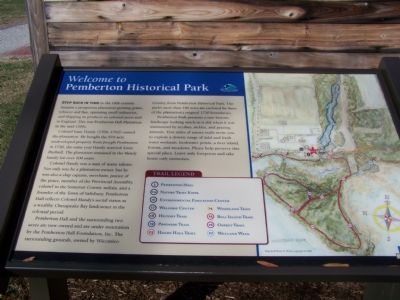
Welcome to Pemberton Historical Park
Colonel Isaac Handy (1706-1762) owned the plantation. He bought the 970-acre undeveloped property from Joseph Pemberton in 1726, the same year Handy married Anne Dashiell. The plantation remained in the Handy family for over 100 years.
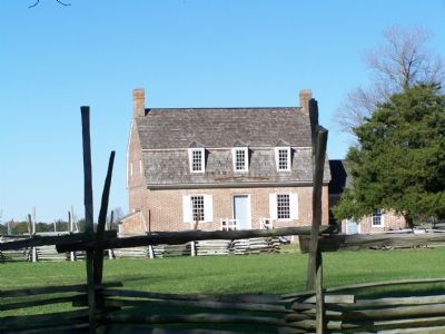
Colonel Handy was a man of many talents. Not only was he a plantation owner, but he was also a ship captain, merchant, justice of the peace, member of the Provincial Assembly, colonel in the Somerset County militia, and a founder of the Town of Salisbury. Pemberton Hall reflects Colonel Handy's social status as a wealthy Chesapeake Bay landowner in the colonial period.
Pemberton Hall and the surrounding two acres are now owned and are under restoration by the Pemberton Hall Foundation, Inc. The surrounding grounds, owned by Wicomico County form Pemberton Historical Park. The park's more than 250 acres are enclosed by three of the plantation's original 1750 boundaries.
Pemberton Park presents a rare historic landscape looking much as it did when it was maintained by scythes, sickles and grazing animals. Five miles of nature trails invite you to explore a diverse range of tidal and fresh water wetlands, freshwater ponds, a river island, forests, and meadows. Please help preserve this special place. Leave only footprints and take home only memories.
Topics. This historical marker is listed in these topic lists: Agriculture • Colonial Era • Parks & Recreational Areas. A significant historical year for this entry is 1726.
Location. 38° 20.839′ N, 75° 38.587′ W. Marker is in Salisbury, Maryland, in Wicomico County. Marker is on Pemberton Historic Park Road, 0.4 miles Pemberton Drive. Touch for map. Marker is in this post office area: Salisbury MD 21802, United States of America. Touch for directions.
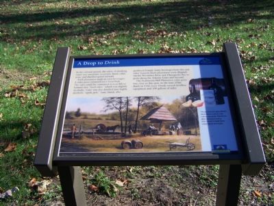
Other nearby markers. At least 8 other markers are within walking distance of this marker. Plantation Barnyard (a few steps from this marker); The "Peculiar Institution" at Pemberton Plantation (within shouting distance of this marker); A Show of Wealth (about 300 feet away, measured in a direct line); A Drop to Drink (about 300 feet away); Pemberton Hall (about 400 feet away); The Road to Salisbury Town (about 400 feet away); Nature's Pasture (about 500 feet away); The Original Residents (about 700 feet away). Touch for a list and map of all markers in Salisbury.

Photographed By William Pfingsten, November 23, 2007
4. One of many descriptive markers on the plantation
The "Peculiar Institution" at Pemberton Plantation
Like most 18th-century plantations in the Chesapeake region, Pemberton Hall Plantation depended on slave labor. Between 1700 and 1740, some 54,000 slaves were brought to the Chesapeake region.
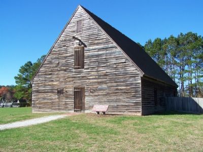
When Isaac Handy died in 1762, records show that he owned 16 slaves. Their "quarter" or place where they gathered, socialized and ate, was a sawn log building measuring 14 x 16 feet, to the east of Pemberton Hall.
Credits. This page was last revised on November 22, 2019. It was originally submitted on November 30, 2007, by Bill Pfingsten of Bel Air, Maryland. This page has been viewed 2,391 times since then and 43 times this year. Photos: 1, 2, 3, 4. submitted on November 30, 2007, by Bill Pfingsten of Bel Air, Maryland.


