Lewes Historic District in Sussex County, Delaware — The American Northeast (Mid-Atlantic)
Overfalls Lightship
Lewes Maritime History Trail
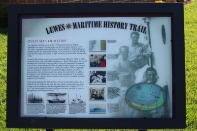
The Lightship Overfalls is one of the 179 ships that served as floating lighthouses on America's three coasts and the Great Lakes between 1820 and 1985. Lightships were used where it was not feasible to build a lighthouse, possibly because the water was too deep or the shoals were constantly shifting. Each ship had a light for visibility at night and some mechanism for making noise in fog.
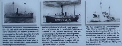
Several of these ships served in and around Delaware Bay from 1823 to 1972, eventually being replaced by either lighthouses or buoys. Throughout this period the ships were constantly being upgraded: from sail to mechanical propulsion, from wood to steel construction, from oil lamps to electric lights, and a variety of improvements that added to human safety and comfort. Even so, lightship duty was hazardous for the crews because the ships remained on station in severe storms when all other vessels were advised to seek shelter. In addition, the foghorns were deafening for those on board and often led to permanent hearing damage. Foghorns on the vessel in front of you, for example, could be heard for up to five miles.
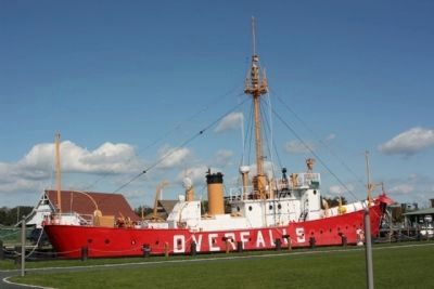
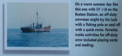
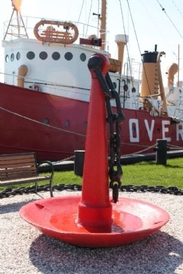
Although the lightship, LV 118, did not serve on the Overfalls station, she is similar to the last ship that did. And she is an historic vessel in her own right, serving on three stations on the New England Coast from 1938 to 1972. In 1973, she was brought to Delaware and given the name Overfalls in honor of the lightship station closet to Lewes.
Erected by City of Lewes. (Marker Number 3.)
Topics and series. This historical marker is listed in this topic list: Waterways & Vessels. In addition, it is included in the Lighthouses series list. A significant historical year for this entry is 1820.
Location. 38° 46.683′ N, 75° 8.482′ W. Marker is in Lewes, Delaware, in Sussex County. It is in the Lewes Historic District. Marker is on Shipcarpenter Street near Pilottown Road, on the right when traveling north. Touch for map. Marker is in this post office area: Lewes DE 19958, United States of America. Touch for directions.
Other nearby markers. At least 8 other markers are within walking distance of this marker. Life Saving Station (here, next to this marker); The Blizzard of 1888 (a few steps from this marker); The Lightship Overfalls LV-118/WAL-539 (a few steps from this marker); Lightship LV-118 Overfalls (a few steps from this marker); Menhaden Fishing Industry (a few steps from this marker); Lightship Overfalls (within shouting distance of this marker); Monomoy History & Restoration (within shouting distance of this marker); Shipbuilding (about 500 feet away, measured in a direct line). Touch for a list and map of all markers in Lewes.
Also see . . .
1. Lightship Overfalls LV 118/WAL 538. From Friends of the Lighthouse website entry:
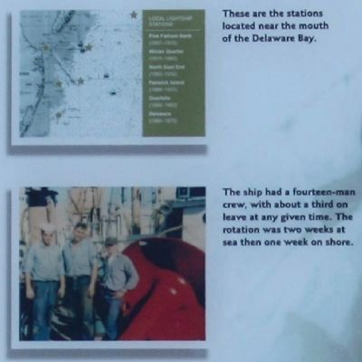
The Overfalls Lightship Station was located near the mouth of Delaware Bay, roughly three miles east of Cape Henlopen and 8.5 miles southwest of Cape May, and marked the Overfalls Shoal where the shallowest spot had a depth of only ten feet. (Submitted on December 9, 2010, by Mike Stroud of Bluffton, South Carolina.)
2. United States lightship Overfalls (LV-118). Wikipedia entry (Submitted on August 13, 2023, by Larry Gertner of New York, New York.)
Photographed By Mike Stroud, 2010
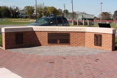
8. Overfalls Lightship nearby Memorial
The Lightship Overfalls LV-118/Wal-539
had a long, distinguished career marking
the shoal waters and guiding ships to
safe harbor on the East Coast. After
decommissioning, the Coast Guard
donated her to the Lewes Historical
Society (LHS) and she was moved to this
location in 1974, with the assistance of
the City of Lewes, and the State of Delaware.
In 2001 the Overfalls Foundation, a local nonprofit group, received the lightship from the LHS. By 2010 the Overfalls Foundation had saved the lightship from deterioration, and preserved it through innumberable hours of volunteer labor and tremendous support by individuals, organizations, businesses, foundations, and government entities. "The Dirty Hands Gang" met on Tuesday mornings to clean, scrape, paint, and repair the lightship. Countless other overfalls Foundation volunteers worked on administrative, political, and social activities that were crucial to the restoration and saving of the ship for future generations.
Names and Organizations listed at left and right
Credits. This page was last revised on September 18, 2023. It was originally submitted on December 9, 2010, by Mike Stroud of Bluffton, South Carolina. This page has been viewed 1,024 times since then and 70 times this year. Photos: 1, 2, 3, 4, 5, 6, 7, 8, 9. submitted on December 9, 2010, by Mike Stroud of Bluffton, South Carolina.
