Salem, Virginia — The American South (Mid-Atlantic)
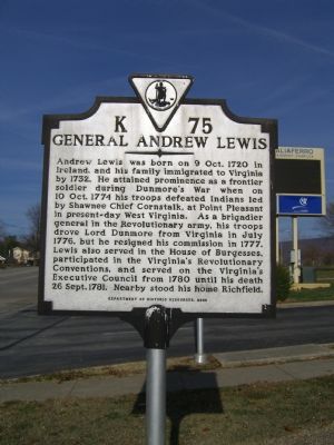
General Andrew Lewis
Erected 2000 by Department of Historic Resources. (Marker Number K-75.)
Topics and series. This historical marker is listed in these topic lists: Colonial Era • Settlements & Settlers • War, US Revolutionary • Wars, US Indian. In addition, it is included in the Virginia Department of Historic Resources (DHR) series list. A significant historical year for this entry is 1774.
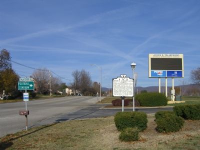
Location. 37° 17.037′ N, 80° 2.445′ W. Marker is in Salem, Virginia. Marker is at the intersection of Roanoke Blvd and Taliaferro Way, on the right when traveling north on Roanoke Blvd. Marker is located at the entrance to the Salem Civic Center. Touch for map. Marker is at or near this postal address: 1001 Roanoke Boulevard, Salem VA 24153, United States of America. Touch for directions.
Other nearby markers. At least 8 other markers are within walking distance of this marker. General Andrew Lewis of Salem (about 400 feet away, measured in a direct line); Lynchburg and Salem Turnpike (approx. 0.6 miles away); a different marker also named General Andrew Lewis (approx. ¾ mile away); World War 1917 - 1919 Memorial (approx. 0.8 miles away); To honor our Confederate Soldiers (approx. 0.8 miles away); Sgt. James Walton (approx. 0.8 miles away); Andrew Lewis’ Grave (approx. 0.8 miles away); East Hill Cemetery North (approx. 0.9 miles away). Touch for a list and map of all markers in Salem.
More about this marker. This marker replaced a marker with the same title and number originally erected in the late 1920s or early 1930s which read, “Richfield, home of Andrew Lewis , famous colonial and Revolutionary soldier, is marked by the knoll and locust trees a half mile east of this spot.”
Related markers. Click here for a list of markers that are related to this marker. Each of these markers is about General Andrew Lewis of Salem, VA.
Credits. This page was last revised on December 27, 2019. It was originally submitted on December 1, 2007, by Kevin W. of Stafford, Virginia. This page has been viewed 1,620 times since then and 24 times this year. Photos: 1, 2. submitted on December 1, 2007, by Kevin W. of Stafford, Virginia.

