Williamsport in Washington County, Maryland — The American Northeast (Mid-Atlantic)
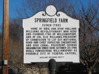
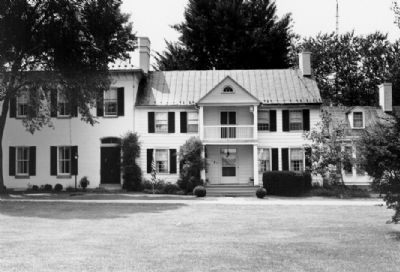
Springfield Farm
(Circa 1755)
Erected by Maryland Historical Society.
Topics and series. This historical marker is listed in these topic lists: Agriculture • Patriots & Patriotism • Roads & Vehicles • Settlements & Settlers • War, US Revolutionary • Waterways & Vessels. In addition, it is included in the Chesapeake and Ohio (C&O) Canal, the Former U.S. Presidents: #01 George Washington, the George Washington Slept Here, and the The Historic National Road series lists. A significant historical date for this entry is October 20, 1790.
Location. 39° 36.131′ N, 77° 48.809′ W. Marker is in Williamsport, Maryland, in Washington County. Marker is at the intersection of E. Potomac Street (U.S. 11) and Springfield Lane, on the right when traveling east on E. Potomac Street. Touch for map. Marker is in this post office area: Williamsport MD 21795, United States of America. Touch for directions.
Other nearby markers. At least 8 other markers are within walking distance of this marker. Williamsport (approx. 0.2 miles away); The Wagoner's Fight - July 6, 1863 (approx. 0.2 miles away); a different marker also named Williamsport (approx. 0.2 miles away); Boy Scout Troop 17, 100 Years Old (approx. ¼ mile away); Band Stand (approx. ¼ mile away); a different marker also named The Springfield Farm (approx. 0.3 miles away); The Wagon Train of the Wounded and Williamsport (approx. 0.3 miles away); Confederate Hospitals in Williamsport (approx. 0.4 miles away). Touch for a list and map of all markers in Williamsport.
Also see . . . Springfield Farm. Maryland Historical Trust website entry (Submitted on December 1, 2007, by F. Robby of Baltimore, Maryland.)
Credits. This page was last revised on February 23, 2022. It was originally submitted on December 1, 2007, by F. Robby of Baltimore, Maryland. This page has been viewed 2,145 times since then and 17 times this year. Photos: 1, 2. submitted on December 1, 2007, by F. Robby of Baltimore, Maryland.

