Tompkinsville in Monroe County, Kentucky — The American South (East South Central)
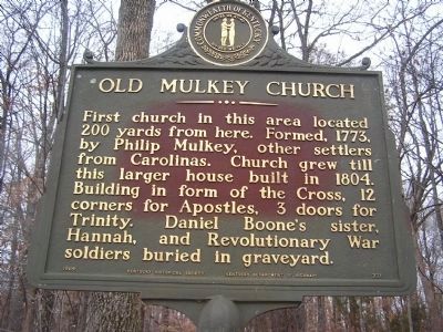
Old Mulkey Church
Erected 1964 by Kentucky Historical Society and Kentucky Dept. of Highways. (Marker Number 721.)
Topics and series. This historical marker is listed in these topic lists: Cemeteries & Burial Sites • Churches & Religion • Settlements & Settlers • War, US Revolutionary. In addition, it is included in the Kentucky Historical Society series list. A significant historical year for this entry is 1773.
Location. 36° 40.673′ N, 85° 42.239′ W. Marker is in Tompkinsville, Kentucky, in Monroe County. Marker is at the intersection of Old Mulkey Road (State Highway 1446) and Corinth Church Road, on the right when traveling south on Old Mulkey Road. Touch for map. Marker is at or near this postal address: 38 Old Mulkey Park Road, Tompkinsville KY 42167, United States of America. Touch for directions.
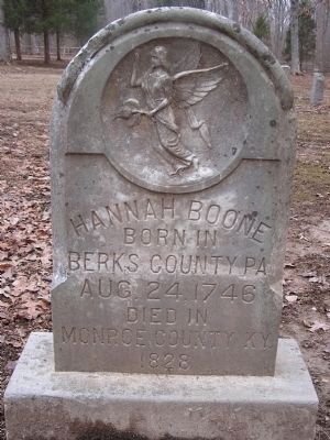
Other nearby markers. At least 8 other markers are within walking distance of this marker. Hannah Boone Pennington (here, next to this marker); Rev. W. E. Thomas (approx. 0.2 miles away); The Book of Records (approx. 0.2 miles away); Hannah Boone (approx. 0.2 miles away); Revolutionary War Veterans (approx. 0.2 miles away); Five Generations of Gospel Preachers (approx. 0.2 miles away); Ephraim Dicken (approx. 0.2 miles away); William & Jane (Hart) Howard (approx. 0.2 miles away). Touch for a list and map of all markers in Tompkinsville.
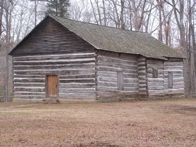
Regarding Old Mulkey Church. The second oldest log freestanding meeting house in Kentucky was built in 1804 during a period of religious revival.
Additional commentary.
1. History has a way of repeating itself.
While researching my father’s family history, of which very little is known, to his amazement I discovered he is the 4th great grandson of Rev. Phillip Mulkey.
Although my father grew up in the moonshine drenched hills of North Ga., with very little, if any, Christian influence of note. He himself became an ordained minister of the United Pentecostal faith. Although not Baptist, Rev. Jimmy Ray is, ‘as his fathers before him’, refusing to follow the traditional route. His ordained faith is by all accounts very much within the same strict and unyielding requirements required by his Great Grandfather the Rev. Phillip Mulkey of the separatist movement.
Over two hundred years of growth, progress and loss could not change who he is. With voiceless validity History has once again overcome and, in my family, completed yet another circle.
With all that I am,
Jeannie Ray Ingram, daughter of;
Rev.Jimmy Ray, son of;
Clair Mulkey, daughter of;
Jessie J. Mulkey, son of;
Lafayette J. Mulkey, Son of;
Benjamin W. Mulkey, son of;
James C. (J.C) Mulkey, son of;
Rev. Phillip Mulkey
— Submitted August 21, 2011, by Jeannie Ingram of Ball Ground, Georgia.
Credits. This page was last revised on November 4, 2020. It was originally submitted on January 1, 2011, by Chad Comer of Gamaliel, Kentucky. This page has been viewed 1,279 times since then and 30 times this year. Photos: 1, 2, 3, 4. submitted on January 5, 2011, by Chad Comer of Gamaliel, Kentucky. • Syd Whittle was the editor who published this page.
Editor’s want-list for this marker. Wide area view of the marker and its surroundings. • Can you help?


